|
search place name
|
||
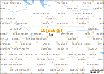
Lutjegast (Groningen, Netherlands)Lutjegast is a town in the Groningen region of Netherlands. An overview map of the region around Lutjegast is displayed below.
regional and 3d topo map of Lutjegast, Netherlands ::
Lutjegast airports ::
The nearest airport is GRQ - Groningen Eelde, located 24.4 km south east of Lutjegast.
Other airports nearby include LWR - Leeuwarden (33.8 km west), BMK - Borkum (49.9 km north east), EME - Emden (66.4 km east), NRD - Norderney (82.9 km north east), Nearby towns ::
Mieden (1.1km west) //
Grootegast (2.2km south east) //
Westerhorn (2.2km north east) //
Eibersburen (2.2km north west) //
Dorp (2.2km west) //
Oude Gaarkeuken (2.9km south east) //
Sebaldeburen (2.9km south east) //
Doezum (3.9km south) //
Buikstede (2.9km north east) //
Visvliet (3.9km north) //
De Jouwer (4.3km south east) //
Het Peebos (4.3km south west) //
Grijpskerk (4.3km north east) //
Burum (4.3km north west) //
Westerzand (3.3km east) //
Stroobos (3.3km west) //
De Schans (5.6km north) //
Pieterzijl (5.6km north) //
Surhuizumermieden (3.8km south west) //
Kuzemerbalk (3.8km south east) //
Kornhorn (5.7km south) //
De Snipperij (5.7km south) //
Gaarkeuken (3.8km north east) //
Leegte (5.7km north) //
Lucaswolde (6.0km south) //
De Keegen (6.0km north) //
Oosterzand (4.4km east) //
Krabbeburen (7.4km north) //
Munnekezijl (7.4km north) //
[all distances 'as the bird flies' and approximate] 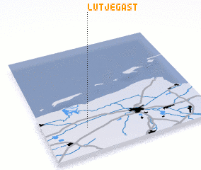 Places with similar names to Lutjegast, Netherlands :: Disclaimer :: Information on this page comes without warranty of any kind |
||
|
Where is Lutjegast? Elevation and coordinates ::
Latitude (lat): 53°14'0"N Longitude (lon): 6°16'0"E
Elevation (approx.): -2m (map arrows pan, magnifying glasses zoom) |
||
|
Visiting Lutjegast? Hotel/Accommodation ::
Book a hotel in Lutjegast Travel Guide ::
Buy a travel guide for Netherlands rental cars ::
car rental offers GPS waypoint ::
download a GPX waypoint (PoI) of Lutjegast for your GPS receiver
|
||