|
search place name
|
||
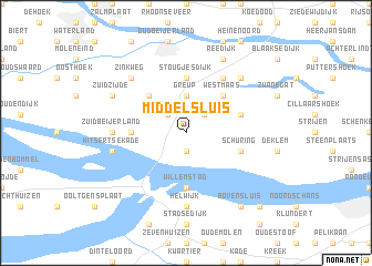
Middelsluis (Zuid-Holland, Netherlands)Middelsluis is a town in the Zuid-Holland region of Netherlands. An overview map of the region around Middelsluis is displayed below.
regional and 3d topo map of Middelsluis, Netherlands ::
Middelsluis airports ::
The nearest airport is RTM - Rotterdam, located 23.0 km north of Middelsluis.
Other airports nearby include WOE - Woensdrecht (34.1 km south), LID - Valkenburg (46.3 km north), ANR - Antwerp Deurne (62.4 km south), AMS - Amsterdam Schiphol (66.2 km north), Nearby towns ::
Numansdorp (1.9km south) //
Bommelskous (2.2km north west) //
Klaaswaal (2.2km north east) //
Oudesluis (2.2km north east) //
Greup (3.7km north) //
Vuurbaken (4.4km north west) //
Westmaas (4.4km north east) //
Willemstad (5.6km south) //
Stougjesdijk (5.6km north) //
Schenkeldijk (3.4km west) //
Oudendijk (3.9km north east) //
Schuring (3.9km south east) //
Westdijk (6.0km north) //
Maasdijk (6.0km north) //
Zuid-Beijerland (4.6km west) //
Helwijk (7.4km south) //
Hitsertse Kade (5.0km west) //
Mijnsheerenland (6.5km north east) //
Zinkweg (6.5km north west) //
Zuidzijde (5.9km north west) //
Reedijk (7.8km north) //
Bovensluis (8.2km south east) //
Tonnekreek (8.7km south east) //
[all distances 'as the bird flies' and approximate] 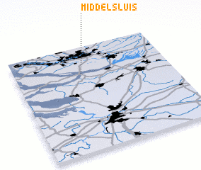 Places with similar names to Middelsluis, Netherlands :: Disclaimer :: Information on this page comes without warranty of any kind |
||
|
Where is Middelsluis? Elevation and coordinates ::
Latitude (lat): 51°45'0"N Longitude (lon): 4°26'0"E
(map arrows pan, magnifying glasses zoom) |
||
|
Visiting Middelsluis? Hotel/Accommodation ::
Book a hotel in Middelsluis Travel Guide ::
Buy a travel guide for Netherlands rental cars ::
car rental offers GPS waypoint ::
download a GPX waypoint (PoI) of Middelsluis for your GPS receiver
|
||