|
search place name
|
||
Mispeleind (Noord-Brabant, Netherlands)Mispeleind is a town in the Noord-Brabant region of Netherlands. An overview map of the region around Mispeleind is displayed below.
regional and 3d topo map of Mispeleind, Netherlands ::

Mispeleind airports ::
The nearest airport is EIN - Eindhoven, located 15.5 km east of Mispeleind.
Other airports nearby include ANR - Antwerp Deurne (54.6 km south west), WOE - Woensdrecht (57.6 km west), MST - Maastricht (68.8 km south east), BRU - Brussels Natl (Melsbroek) (73.2 km south west), Nearby towns ::
Braakhoek (1.2km east) //
Heikant (1.2km east) //
Vloeieind (1.2km west) //
Lage Mierde (1.2km west) //
Vooreind (1.9km south) //
Hulsel (2.2km south east) //
De Hoef (2.2km south east) //
Wellenseind (2.2km north west) //
Reusel (3.7km south) //
Netersel (2.3km east) //
Dun (3.7km north) //
Kuilenrode (2.3km west) //
Holland (3.9km south) //
De Voort (3.9km south) //
Franse Hoef (3.0km south east) //
Kippereind (5.6km south) //
Weijereind (5.6km south) //
Heikant (5.7km north) //
Kattenbosch (5.7km south) //
Achterste Heikant (5.7km south) //
Lensheuvel (5.7km south) //
Voorste Heikant (5.7km south) //
De Hoek (5.7km south) //
Het Bosch (3.9km south east) //
Twisselt (3.9km south west) //
Hooge Mierde (3.9km south west) //
Groenstraat (5.7km north) //
Helleneind (5.1km south east) //
Bladel (5.1km south east) //
[all distances 'as the bird flies' and approximate] 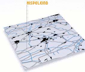 Places with similar names to Mispeleind, Netherlands :: Disclaimer :: Information on this page comes without warranty of any kind |
||
|
Where is Mispeleind? Elevation and coordinates ::
Latitude (lat): 51°24'0"N Longitude (lon): 5°10'0"E
Elevation (approx.): 27m (map arrows pan, magnifying glasses zoom) |
||
|
Visiting Mispeleind? Hotel/Accommodation ::
Book a hotel in Mispeleind Travel Guide ::
Buy a travel guide for Netherlands rental cars ::
car rental offers GPS waypoint ::
download a GPX waypoint (PoI) of Mispeleind for your GPS receiver
|
||