|
search place name
|
||
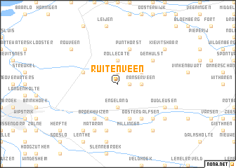
Ruitenveen (Overijssel, Netherlands)Ruitenveen is a town in the Overijssel region of Netherlands. An overview map of the region around Ruitenveen is displayed below.
regional and 3d topo map of Ruitenveen, Netherlands ::
Ruitenveen airports ::
The nearest airport is ENS - Enschede Twenthe, located 53.8 km south east of Ruitenveen.
Other airports nearby include GRQ - Groningen Eelde (65.4 km north), LWR - Leeuwarden (80.7 km north west), UTC - Soesterberg (82.4 km south west), AMS - Amsterdam Schiphol (105.1 km west), Nearby towns ::
De Meele (1.9km north) //
Ruitenhuizen (1.1km east) //
Ranserveen (2.3km east) //
Rollecate (3.7km north) //
Engeland (3.7km south) //
Nieuwleusen (2.9km north east) //
Lichtmis (3.9km north west) //
Ankum (5.7km south) //
Gerner (5.7km south) //
Punthorst (5.7km north) //
Ooster-Dalfsen (6.0km south) //
Broekhuizen (6.0km south) //
Den Hulst (5.0km north east) //
Dalfsen (7.5km south) //
Emmen (7.5km south) //
Millingen (7.5km south) //
Welsum (6.5km south east) //
Mataram (7.7km south) //
Oudleusen (5.8km south east) //
Hessum (7.2km south east) //
Rechteren (8.1km south east) //
De Marshoek (8.1km south west) //
Rouveen (7.2km north west) //
Kievitshaar (7.2km north east) //
[all distances 'as the bird flies' and approximate] 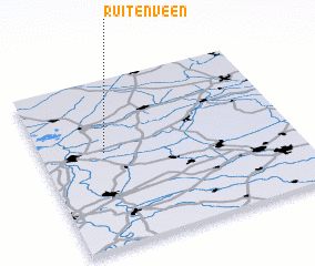 Places with similar names to Ruitenveen, Netherlands :: Disclaimer :: Information on this page comes without warranty of any kind |
||
|
Where is Ruitenveen? Elevation and coordinates ::
Latitude (lat): 52°34'0"N Longitude (lon): 6°15'0"E
(map arrows pan, magnifying glasses zoom) |
||
|
Visiting Ruitenveen? Hotel/Accommodation ::
Book a hotel in Ruitenveen Travel Guide ::
Buy a travel guide for Netherlands rental cars ::
car rental offers GPS waypoint ::
download a GPX waypoint (PoI) of Ruitenveen for your GPS receiver
|
||