|
search place name
|
||
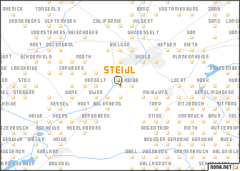
Steijl (Limburg, Netherlands)Steijl is a town in the Limburg region of Netherlands. An overview map of the region around Steijl is displayed below.
regional and 3d topo map of Steijl, Netherlands ::
Steijl airports ::
The nearest airport is MGL - Moenchengladbach Monchengladbach, located 28.3 km south east of Steijl.
Other airports nearby include GKE - Geilenkirchen (41.9 km south), DUS - Duesseldorf Dusseldorf (44.4 km east), MST - Maastricht (53.4 km south west), EIN - Eindhoven (54.4 km west), Nearby towns ::
Nabben (0.0km north) //
Leemhorst (0.0km north) //
Tegelen (0.0km north) //
Geloo (1.9km south) //
Heide (1.2km east) //
Belfeld (2.2km south west) //
Broek (2.2km north east) //
Vergelt (2.3km west) //
Baarlo (2.3km west) //
Hout-Blerick (3.7km north) //
Oijen (3.0km south west) //
Bolenberg (3.9km south) //
Schafelt (3.0km north west) //
Heidenend (3.0km south east) //
Blerick (4.4km north east) //
Venlo (4.4km north east) //
Wielder (5.6km north) //
Bong (3.5km west) //
Soeterbeek (3.5km west) //
Boekend (5.7km north) //
In die Juys (3.9km south east) //
Ubroek (5.7km north) //
Dubbroek (3.9km north west) //
Hert (3.9km north west) //
Offenbeek (6.0km south west) //
Tomp (5.1km south east) //
Stevensend (5.1km south east) //
Hout (5.1km south west) //
Heidhausen (6.0km south east) //
[all distances 'as the bird flies' and approximate]  Places with similar names to Steijl, Netherlands ::
Disclaimer :: Information on this page comes without warranty of any kind |
||
|
Where is Steijl? Elevation and coordinates ::
Latitude (lat): 51°20'0"N Longitude (lon): 6°8'0"E
Elevation (approx.): 25m (map arrows pan, magnifying glasses zoom) |
||
|
Visiting Steijl? Hotel/Accommodation ::
Book a hotel in Steijl Travel Guide ::
Buy a travel guide for Netherlands rental cars ::
car rental offers GPS waypoint ::
download a GPX waypoint (PoI) of Steijl for your GPS receiver
|
||