|
search place name
|
||
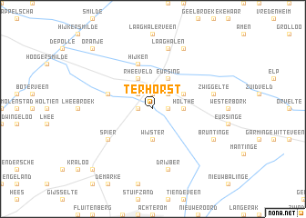
Ter Horst (Drenthe, Netherlands)Ter Horst is a town in the Drenthe region of Netherlands. An overview map of the region around Ter Horst is displayed below.
regional and 3d topo map of Ter Horst, Netherlands ::
Ter Horst airports ::
The nearest airport is GRQ - Groningen Eelde, located 30.3 km north of Ter Horst.
Other airports nearby include LWR - Leeuwarden (65.9 km north west), ENS - Enschede Twenthe (68.9 km south), EME - Emden (76.8 km north east), BMK - Borkum (84.0 km north), Nearby towns ::
Lieving (1.1km east) //
Makkum (1.1km east) //
Smalbroek (1.1km west) //
Beilen (1.9km north) //
Alting (2.2km north east) //
Brunsting (2.2km north west) //
Holthe (2.2km east) //
Wijster (3.7km south) //
Eursing (3.9km north) //
Rheeveld (3.9km north) //
Klatering (2.9km north east) //
Hijken (5.7km north) //
Beilervaart (3.8km north west) //
Spier (5.0km south west) //
Zwiggelte (4.8km north east) //
Drijber (7.5km south) //
Laaghalen (7.5km north) //
Bruntinge (5.8km south east) //
Hooghalen (7.7km north) //
Eursinge (8.7km south west) //
Oranje (8.7km north west) //
Nuil (8.7km south west) //
[all distances 'as the bird flies' and approximate] 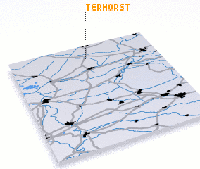 Places with similar names to Ter Horst, Netherlands ::
Disclaimer :: Information on this page comes without warranty of any kind |
||
|
Where is Ter Horst? Elevation and coordinates ::
Latitude (lat): 52°51'0"N Longitude (lon): 6°31'0"E
Elevation (approx.): 11m (map arrows pan, magnifying glasses zoom) |
||
|
Visiting Ter Horst? Hotel/Accommodation ::
Book a hotel in Ter Horst Travel Guide ::
Buy a travel guide for Netherlands rental cars ::
car rental offers GPS waypoint ::
download a GPX waypoint (PoI) of Ter Horst for your GPS receiver
|
||