|
search place name
|
||
Wijns (Friesland, Netherlands)Wijns is a town in the Friesland region of Netherlands. An overview map of the region around Wijns is displayed below.
regional and 3d topo map of Wijns, Netherlands ::

Wijns airports ::
The nearest airport is LWR - Leeuwarden, located 5.4 km south west of Wijns.
Other airports nearby include GRQ - Groningen Eelde (51.9 km east), BMK - Borkum (69.8 km north east), DHR - De Kooy (79.3 km south west), EME - Emden (94.2 km east), Nearby towns ::
Miedum (1.9km south) //
Tichelwerk (1.9km north) //
Lekkum (2.2km south west) //
Bartlehiem (3.7km north) //
Tergracht (3.9km north) //
Bilgaard (4.3km south west) //
Snakkerburen (4.3km south west) //
Wanswerd aan de Streek (4.3km north east) //
Wilaard (5.6km south) //
Cornjum (3.3km west) //
Britsum (3.3km west) //
Heechterp (5.7km south) //
Wanswerd (5.7km north) //
ʼt Haantje (3.8km south west) //
Vensterburen (3.8km south west) //
Jelsum (3.8km south west) //
Oudkerk (3.8km north east) //
Giekerk (3.8km south east) //
Giekerkerhoek (3.8km south east) //
Huizem (6.0km south) //
Hempens (7.4km south) //
Teerns (7.4km south) //
Oenkerk (4.4km east) //
Stiens (4.8km north west) //
Aldlan (7.5km south) //
Westeinde (6.5km south west) //
Leeuwarden (6.5km south west) //
Birdaard (6.5km north east) //
Goutum (7.7km south) //
[all distances 'as the bird flies' and approximate] 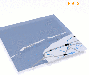 Places with similar names to Wijns, Netherlands ::
Disclaimer :: Information on this page comes without warranty of any kind |
||
|
Where is Wijns? Elevation and coordinates ::
Latitude (lat): 53°15'0"N Longitude (lon): 5°50'0"E
Elevation (approx.): -1m (map arrows pan, magnifying glasses zoom) |
||
|
Visiting Wijns? Hotel/Accommodation ::
Book a hotel in Wijns Travel Guide ::
Buy a travel guide for Netherlands rental cars ::
car rental offers GPS waypoint ::
download a GPX waypoint (PoI) of Wijns for your GPS receiver
|
||