|
search place name
|
||
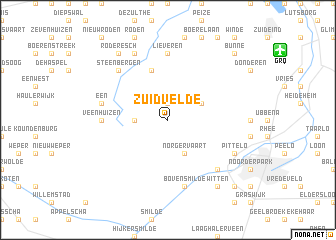
Zuidvelde (Drenthe, Netherlands)Zuidvelde is a town in the Drenthe region of Netherlands. An overview map of the region around Zuidvelde is displayed below.
regional and 3d topo map of Zuidvelde, Netherlands ::
Zuidvelde airports ::
The nearest airport is GRQ - Groningen Eelde, located 10.8 km north east of Zuidvelde.
Other airports nearby include LWR - Leeuwarden (51.3 km north west), BMK - Borkum (62.8 km north), EME - Emden (63.4 km north east), NRD - Norderney (89.0 km north east), Nearby towns ::
Norg (1.9km north) //
Westervelde (2.2km west) //
Norgervaart (3.9km south) //
Peest (2.9km north east) //
Langelo (5.7km north) //
Veenhuizen (4.5km west) //
Lieveren (7.4km north) //
Bovensmilde (7.5km south) //
Een (4.8km north west) //
Kloosterveen (6.5km south east) //
Steenbergen (6.5km north west) //
Pittelo (5.8km south east) //
Alteveer (7.7km north) //
Witten (8.1km south east) //
Roderesch (8.1km north west) //
Kort Bossen (8.7km south east) //
Bunne (8.6km north east) //
[all distances 'as the bird flies' and approximate] 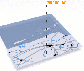 Places with similar names to Zuidvelde, Netherlands ::
Disclaimer :: Information on this page comes without warranty of any kind |
||
|
Where is Zuidvelde? Elevation and coordinates ::
Latitude (lat): 53°3'0"N Longitude (lon): 6°28'0"E
Elevation (approx.): 10m (map arrows pan, magnifying glasses zoom) |
||
|
Visiting Zuidvelde? Hotel/Accommodation ::
Book a hotel in Zuidvelde Travel Guide ::
Buy a travel guide for Netherlands rental cars ::
car rental offers GPS waypoint ::
download a GPX waypoint (PoI) of Zuidvelde for your GPS receiver
|
||