|
search place name
|
||
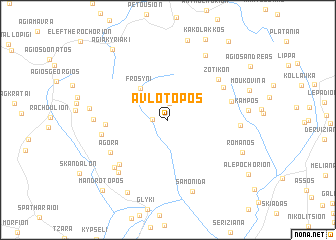
Avlótopos (Thesprotía, Greece)Avlótopos is a town in the Thesprotía region of Greece. An overview map of the region around Avlótopos is displayed below.
regional and 3d topo map of Avlótopos, Greece ::
Avlótopos airports ::
The nearest airport is IOA - Ioannina, located 35.4 km north east of Avlótopos.
Other airports nearby include PVK - Preveza Aktio (55.9 km south), CFU - Kerkyra/corfu Ioannis Kapodistrias Intl (64.7 km west), AGQ - Agrinion (110.1 km south east), KSO - Kastoria Aristotelis (127.4 km north east), Nearby towns ::
Tsangárion (1.3km west) //
Koukoulioí (1.8km north) //
Frosýni (4.3km north west) //
Zervochórion (5.4km west) //
Káto Zotikón (6.0km north east) //
Zotikón (6.3km north east) //
Kotsiáti (6.5km south west) //
Agorá (6.2km south west) //
Bestiá (5.9km east) //
Asfáka (5.9km west) //
Skóza (7.0km south west) //
Gardíkion (7.2km south west) //
Sistroúnion (6.3km east) //
Kamínion (6.4km west) //
Katamáchi (7.9km north east) //
Samonída (8.3km south) //
Prodrómion (6.9km west) //
Pardalítsa (9.0km north) //
Romanós (7.4km south east) //
Chóïka (8.8km south west) //
Agía Kyriakí (9.2km north west) //
Mandrótopos (9.7km south west) //
Artopoúla (10.2km north east) //
[all distances 'as the bird flies' and approximate] 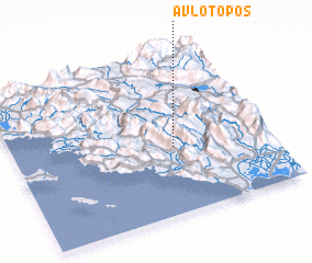 Places with similar names to Avlótopos, Greece :: Disclaimer :: Information on this page comes without warranty of any kind |
||
|
Where is Avlótopos? Elevation and coordinates ::
Latitude (lat): 39°25'0"N Longitude (lon): 20°37'32"E
Elevation (approx.): 552m (map arrows pan, magnifying glasses zoom) |
||
|
Visiting Avlótopos? Hotel/Accommodation ::
Book a hotel in Avlótopos Travel Guide ::
Buy a travel guide for Greece rental cars ::
car rental offers GPS waypoint ::
download a GPX waypoint (PoI) of Avlótopos for your GPS receiver
|
||