|
search place name
|
||
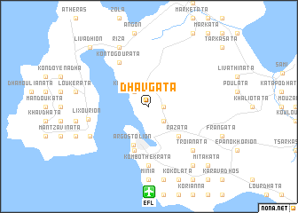
Dhavgáta (Piraiévs, Greece)Dhavgáta is a town in the Piraiévs region of Greece. An overview map of the region around Dhavgáta is displayed below.
regional and 3d topo map of Dhavgáta, Greece ::
Dhavgáta airports ::
The nearest airport is EFL - Keffallinia Kefallinia, located 10.7 km south of Dhavgáta.
Other airports nearby include ZTH - Zakynthos Dionysios Solomos (61.7 km south east), PYR - Andravida (76.9 km south east), GPA - Patras Araxos (81.4 km east), PVK - Preveza Aktio (82.0 km north), Nearby towns ::
Dilináta (1.5km east) //
Kouroukláta (2.4km north west) //
Fársa (2.4km north west) //
Farakláta (2.4km south east) //
Razáta (4.7km south east) //
Argostólion (5.1km south) //
Spiliá (5.7km south) //
Kontogouráta (6.3km north west) //
Kombothekráta (7.4km south) //
Khelmáta (7.4km south) //
Lixoúrion (6.2km west) //
Troïanáta (7.1km south east) //
Ríza (8.0km north) //
Katokhórion (8.0km north) //
Kardhakáta (8.0km north) //
Petrikáta (8.0km north) //
Lépedha (6.9km south west) //
Mikhalitsáta (6.9km south west) //
Dhemoutsandáta (8.6km south east) //
Livádhion (9.4km north west) //
Mitakáta (9.4km south east) //
[all distances 'as the bird flies' and approximate] 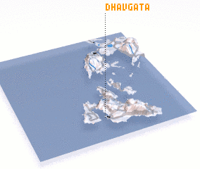 Places with similar names to Dhavgáta, Greece :: Disclaimer :: Information on this page comes without warranty of any kind |
||
|
Where is Dhavgáta? Elevation and coordinates ::
Latitude (lat): 38°13'0"N Longitude (lon): 20°30'0"E
Elevation (approx.): 238m (map arrows pan, magnifying glasses zoom) |
||
|
Visiting Dhavgáta? Hotel/Accommodation ::
Book a hotel in Dhavgáta Travel Guide ::
Buy a travel guide for Greece rental cars ::
car rental offers GPS waypoint ::
download a GPX waypoint (PoI) of Dhavgáta for your GPS receiver
|
||