|
search place name
|
||
(( Kondaíika )) (Kardítsa, Greece)(( Kondaíika )) is a town in the Kardítsa region of Greece. An overview map of the region around (( Kondaíika )) is displayed below.
regional and 3d topo map of (( Kondaíika )), Greece ::

(( Kondaíika )) airports ::
The nearest airport is AGQ - Agrinion, located 74.9 km south west of (( Kondaíika )).
Other airports nearby include LRA - Larissa Larisa (79.3 km north east), VOL - Nea Anghialos Nea Anchialos (90.2 km east), PVK - Preveza Aktio (90.5 km west), IOA - Ioannina (97.0 km north west), Nearby towns ::
Agía Agáthi (2.2km south east) //
Karoplésion (3.1km south) //
Petrálona (2.9km south west) //
Koutsopápoulos (2.9km north east) //
Moúcha (4.3km north) //
Giannousaíïka (3.7km south east) //
Zygogiannaíïka (5.3km north west) //
Belokomíti (6.3km north) //
Koukkaíïka (6.1km south east) //
Kastaniá (5.9km north east) //
Chaliás (5.4km west) //
Palaiólakka (6.0km south west) //
Mégas Lákkos (6.3km south east) //
Neráïda (6.0km west) //
Prosílion (7.6km south) //
Plakotón (7.4km north west) //
(( Áno Paliozoglópi )) (6.3km east) //
Neráïda (7.5km south east) //
Élatos (6.8km north west) //
Kamária (7.8km south west) //
Karítsa (7.9km north west) //
Neochórion (8.7km north) //
Palaiozoglópi (6.9km east) //
Kokkinaíika (8.8km south) //
Mitsaíika (8.6km south east) //
Rafína (9.2km north west) //
Liapaíika (8.5km south east) //
Zervaíika (9.6km north east) //
(( Boukovítsa )) (9.4km south east) //
[all distances 'as the bird flies' and approximate] 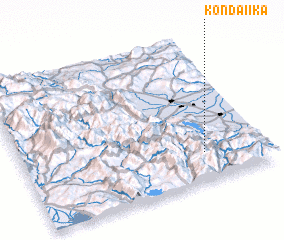 Places with similar names to (( Kondaíika )), Greece ::
Disclaimer :: Information on this page comes without warranty of any kind |
||
|
Where is (( Kondaíika ))? Elevation and coordinates ::
Latitude (lat): 39°12'0"N Longitude (lon): 21°45'0"E
Elevation (approx.): 773m (map arrows pan, magnifying glasses zoom) |
||
|
Visiting (( Kondaíika ))? Hotel/Accommodation ::
Book a hotel in (( Kondaíika )) Travel Guide ::
Buy a travel guide for Greece rental cars ::
car rental offers GPS waypoint ::
download a GPX waypoint (PoI) of (( Kondaíika )) for your GPS receiver
|
||