|
search place name
|
||
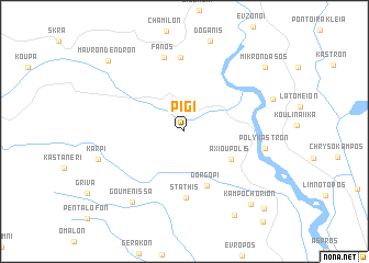
Pigí (Kilkís, Greece)Pigí is a town in the Kilkís region of Greece. An overview map of the region around Pigí is displayed below.
regional and 3d topo map of Pigí, Greece ::
Pigí airports ::
The nearest airport is SKG - Thessaloniki Makedonia, located 67.7 km south east of Pigí.
Other airports nearby include KZI - Kozani Filippos (97.4 km south west), KSO - Kastoria Aristotelis (119.8 km south west), SKP - Skopje (128.4 km north west), OHD - Ohrid (148.2 km west), Nearby towns ::
Axioúpolis (4.6km south east) //
Gorgópi (5.8km south) //
Státhis (6.7km south) //
Plágia (7.5km north) //
Fanós (7.7km north) //
Polýkastron (6.4km east) //
Gouménissa (8.3km south west) //
Kárpi (7.2km south west) //
Toúmpa (9.3km south east) //
Kampochórion (9.0km south east) //
Mikrón Dásos (9.0km north east) //
(( Mávron Déndron )) (9.3km north west) //
Valtotópion (10.0km south east) //
[all distances 'as the bird flies' and approximate] 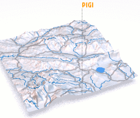 Places with similar names to Pigí, Greece ::
Disclaimer :: Information on this page comes without warranty of any kind |
||
|
Where is Pigí? Elevation and coordinates ::
Latitude (lat): 41°0'32"N Longitude (lon): 22°29'32"E
Elevation (approx.): 223m (map arrows pan, magnifying glasses zoom) |
||
|
Visiting Pigí? Hotel/Accommodation ::
Book a hotel in Pigí Travel Guide ::
Buy a travel guide for Greece rental cars ::
car rental offers GPS waypoint ::
download a GPX waypoint (PoI) of Pigí for your GPS receiver
|
||