|
search place name
|
||
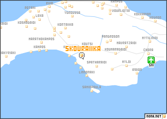
Skouraíika (Sámos, Greece)Skouraíika is a town in the Sámos region of Greece. An overview map of the region around Skouraíika is displayed below.
regional and 3d topo map of Skouraíika, Greece ::
Skouraíika airports ::
The nearest airport is SMI - Samos, located 12.1 km east of Skouraíika.
Other airports nearby include LRS - Leros (56.4 km south), ADB - Izmir Adnan Menderes (74.6 km north east), JKH - Chios (91.2 km north west), IGL - Izmir Cigli (93.4 km north), Nearby towns ::
Neochórion (1.6km north) //
Kámpos (1.6km south west) //
Pérri (1.9km south) //
Koútsi (2.7km north) //
Órmos Koumaíïkon (2.6km west) //
Koumaíïka (2.9km north west) //
Spatharaíoi (2.9km south east) //
Limnonáki (3.8km south) //
Pýrgos (3.4km north east) //
Plátanos (5.7km north west) //
Mesógeion (5.7km north east) //
Pagóndas (5.5km south east) //
Samiopoúla (7.3km south) //
Koumaradaíoi (5.9km east) //
Pándroson (6.5km north east) //
Ágioi Theódori (7.3km north west) //
Kontaíïka (7.7km north west) //
Sevastaíïka (7.5km north west) //
Órmos Marathokámpou (6.8km west) //
Sakkoulaíïka (8.2km north west) //
Sourídes (8.7km north west) //
[all distances 'as the bird flies' and approximate] 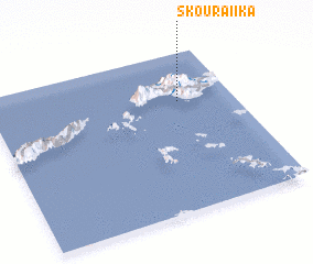 Places with similar names to Skouraíika, Greece ::
// Segraga (MA)
// Şükürçü (AZ)
// Zagorka (RU)
// Zagorok (RU)
// Zui-Gorka (RU)
// Schaueregg (AT)
// Schaueregg (AT)
// Schrick (AT)
// Schröck (AT)
// Scheuereck (DE)
Disclaimer :: Information on this page comes without warranty of any kind |
||
|
Where is Skouraíika? Elevation and coordinates ::
Latitude (lat): 37°41'33"N Longitude (lon): 26°46'27"E
Elevation (approx.): 188m (map arrows pan, magnifying glasses zoom) |
||
|
Visiting Skouraíika? Hotel/Accommodation ::
Book a hotel in Skouraíika Travel Guide ::
Buy a travel guide for Greece rental cars ::
car rental offers GPS waypoint ::
download a GPX waypoint (PoI) of Skouraíika for your GPS receiver
|
||