|
search place name
|
||
Agro (Aveiro, Portugal)Agro is a town in the Aveiro region of Portugal. An overview map of the region around Agro is displayed below.
regional and 3d topo map of Agro, Portugal ::

Agro airports ::
The nearest airport is OPO - Porto, located 55.9 km north of Agro.
Other airports nearby include VRL - Vila Real (93.1 km north east), VGO - Vigo (164.6 km north), BGC - Braganca (199.6 km north east), LIS - Lisbon Lisboa (223.7 km south), Nearby towns ::
Outeiro do Coval (1.4km east) //
Antuã (1.4km east) //
Estarreja (1.4km east) //
Senhora do Monte (1.4km east) //
Areia (1.4km west) //
Olas (1.4km west) //
Cabeças (1.4km west) //
Póvoa de Baixo (1.9km north) //
Póvoa de Cima (1.9km north) //
Cadaval (2.3km south east) //
Ladeira (2.3km south east) //
Beduido (2.3km north east) //
Vale da Rama (2.3km south east) //
Feiro (2.3km south east) //
Carvalha (2.8km east) //
Campinos (2.8km east) //
Senhor do Terço (2.8km east) //
Sardinha (3.7km north) //
Veiros (2.8km west) //
São Geraldo (2.8km west) //
Telhões (2.8km west) //
Igreja (2.8km west) //
Falcão (4.0km north) //
Salreu (3.4km south east) //
Adou de Cima (3.4km south east) //
Santo Amaro (3.4km north east) //
Canada (3.4km south east) //
Picoto (4.7km south east) //
Canelas (4.7km south east) //
[all distances 'as the bird flies' and approximate] 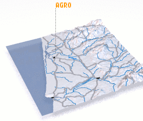 Places with similar names to Agro, Portugal ::
Disclaimer :: Information on this page comes without warranty of any kind |
||
|
Where is Agro? Elevation and coordinates ::
Latitude (lat): 40°45'0"N Longitude (lon): 8°35'0"W
(map arrows pan, magnifying glasses zoom) |
||
|
Visiting Agro? Hotel/Accommodation ::
Book a hotel in Agro Travel Guide ::
Buy a travel guide for Portugal rental cars ::
car rental offers GPS waypoint ::
download a GPX waypoint (PoI) of Agro for your GPS receiver
|
||