|
search place name
|
||
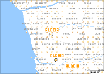
Aldeia (Braga, Portugal)Aldeia is a town in the Braga region of Portugal. An overview map of the region around Aldeia is displayed below.
regional and 3d topo map of Aldeia, Portugal ::
Aldeia airports ::
The nearest airport is OPO - Porto, located 39.3 km south of Aldeia.
Other airports nearby include VGO - Vigo (70.7 km north), VRL - Vila Real (92.1 km south east), SCQ - Santiago (146.4 km north), LCG - La Coruna A Coruna (191.3 km north), Nearby towns ::
Boucinho (0.0km north) //
Aldreu (1.4km east) //
Forjães (1.4km west) //
Freiria (1.4km west) //
Madorra (1.9km north) //
Santa (1.9km north) //
Monte Branco (1.9km north) //
Granja (2.3km south east) //
Palme (2.3km south east) //
Neiva (2.3km north east) //
Estrada (2.3km north east) //
Costeira (2.3km north west) //
Além da Ribeira (2.3km north west) //
Sardal (3.7km north) //
São Vicente (2.8km east) //
Penedo do Monte (2.8km east) //
Fragoso (2.8km east) //
Curvos (3.7km south) //
Frossos (3.7km south) //
Antas (2.8km west) //
Monte (2.8km west) //
Azevedo (2.8km west) //
Mereces (4.0km south) //
Viso (4.0km north) //
Padrão (4.0km north) //
Meiriçô (4.0km north) //
Pauso (4.0km north) //
Vila Chã (4.0km south) //
Susão (4.0km south) //
[all distances 'as the bird flies' and approximate]  Places with similar names to Aldeia, Portugal ::
Disclaimer :: Information on this page comes without warranty of any kind |
||
|
Where is Aldeia? Elevation and coordinates ::
Latitude (lat): 41°36'0"N Longitude (lon): 8°44'0"W
Elevation (approx.): 104m (map arrows pan, magnifying glasses zoom) |
||
|
Visiting Aldeia? Hotel/Accommodation ::
Book a hotel in Aldeia Travel Guide ::
Buy a travel guide for Portugal rental cars ::
car rental offers GPS waypoint ::
download a GPX waypoint (PoI) of Aldeia for your GPS receiver
|
||