|
search place name
|
||
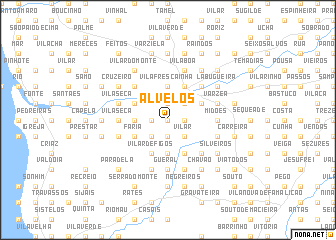
Alvelos (Braga, Portugal)Alvelos is a town in the Braga region of Portugal. An overview map of the region around Alvelos is displayed below.
regional and 3d topo map of Alvelos, Portugal ::
Alvelos airports ::
The nearest airport is OPO - Porto, located 28.3 km south of Alvelos.
Other airports nearby include VRL - Vila Real (80.4 km east), VGO - Vigo (81.3 km north), SCQ - Santiago (156.1 km north), BGC - Braganca (165.2 km east), Nearby towns ::
Varziela (0.0km north) //
Pontegãos (0.0km north) //
Fulões (0.0km north) //
Pereira (0.0km north) //
Remelhe (1.4km east) //
Santa Cruz (1.4km east) //
Pinheiro (1.4km east) //
Quintão (1.4km east) //
Espesês (1.4km west) //
Silgueiros (1.9km south) //
Vila Frescainha (1.9km north) //
Medros (1.9km north) //
Carvalhal (1.9km north) //
Vilar (2.3km south east) //
Barcelinhos (2.3km north east) //
Penedos (2.3km north east) //
Areal de Cima (2.3km north east) //
Torre de Moldes (2.3km south east) //
Malhadouro (2.3km south west) //
Vila Frescainha (3.7km north) //
Santo Amaro (3.7km north) //
Rua Nova (3.7km south) //
Pedra Furada (3.7km south) //
Aldão (3.7km north) //
Cardal (2.8km west) //
Mota (2.8km west) //
Milhazes (2.8km west) //
Barcelos (4.0km north) //
Covas (4.0km south) //
[all distances 'as the bird flies' and approximate]  Places with similar names to Alvelos, Portugal ::
Disclaimer :: Information on this page comes without warranty of any kind |
||
|
Where is Alvelos? Elevation and coordinates ::
Latitude (lat): 41°30'0"N Longitude (lon): 8°38'0"W
Elevation (approx.): 101m (map arrows pan, magnifying glasses zoom) |
||
|
Visiting Alvelos? Hotel/Accommodation ::
Book a hotel in Alvelos Travel Guide ::
Buy a travel guide for Portugal rental cars ::
car rental offers GPS waypoint ::
download a GPX waypoint (PoI) of Alvelos for your GPS receiver
|
||