|
search place name
|
||
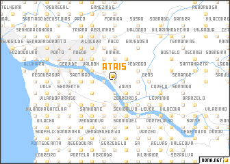
Atãis (Porto, Portugal)Atãis is a town in the Porto region of Portugal. An overview map of the region around Atãis is displayed below.
regional and 3d topo map of Atãis, Portugal ::
Atãis airports ::
The nearest airport is OPO - Porto, located 19.2 km north west of Atãis.
Other airports nearby include VRL - Vila Real (70.4 km east), VGO - Vigo (124.1 km north), BGC - Braganca (173.3 km north east), SCQ - Santiago (197.9 km north), Nearby towns ::
Aguiar (0.0km north) //
Cabanas (0.0km north) //
Ramalde (1.9km north) //
Pevidal (1.9km north) //
Pedreira (1.9km north) //
Espinhaço (1.4km west) //
Avintes (1.4km west) //
Souto (1.9km south) //
Ermentão (2.3km north west) //
Miradouro (2.3km north west) //
Gandra (2.3km north west) //
Pinheiro de Aquém (2.3km north west) //
Jovim (2.3km south east) //
Escoura (2.3km south east) //
Calvário (3.7km north) //
Vinhal (3.7km north) //
Perelada (3.7km north) //
Gondomar (3.7km north) //
Quintã (3.7km north) //
Vilar (3.7km north) //
Santa Eulália (3.7km north) //
Taralhão (3.7km north) //
Ferreirinha (2.8km east) //
Magarão (2.8km west) //
Pousada (2.8km west) //
Arnelas (3.7km south) //
Tardariz (4.0km north) //
São Pedro da Cova (4.0km north) //
Mó (3.4km north east) //
[all distances 'as the bird flies' and approximate]  Places with similar names to Atãis, Portugal ::
Disclaimer :: Information on this page comes without warranty of any kind |
||
|
Where is Atãis? Elevation and coordinates ::
Latitude (lat): 41°7'0"N Longitude (lon): 8°32'0"W
Elevation (approx.): 73m (map arrows pan, magnifying glasses zoom) |
||
|
Visiting Atãis? Hotel/Accommodation ::
Book a hotel in Atãis Travel Guide ::
Buy a travel guide for Portugal rental cars ::
car rental offers GPS waypoint ::
download a GPX waypoint (PoI) of Atãis for your GPS receiver
|
||