|
search place name
|
||
Bouça (Viana do Castelo, Portugal)Bouça is a town in the Viana do Castelo region of Portugal. An overview map of the region around Bouça is displayed below.
regional and 3d topo map of Bouça, Portugal ::

Bouça airports ::
The nearest airport is VGO - Vigo, located 49.4 km north of Bouça.
Other airports nearby include OPO - Porto (63.5 km south), VRL - Vila Real (86.4 km south east), SCQ - Santiago (121.9 km north), BGC - Braganca (147.7 km east), Nearby towns ::
Monte do Aval (0.0km north) //
Távora (1.4km east) //
Bemposta (1.4km east) //
Santa Cruz do Lima (1.9km south) //
Portelas (1.9km south) //
Rio Cabrão (1.4km west) //
Algarvia (1.4km west) //
Jolda (1.4km west) //
Cendufe (1.9km north) //
Távora (1.9km north) //
Balouta (1.9km north) //
Padreiro (1.9km north) //
Lavradas (2.3km south east) //
Paço (2.3km south east) //
Ponte (2.3km north east) //
Casal (2.3km north east) //
Gandra (2.3km south west) //
Carnapata (2.3km south west) //
Olheiro (2.3km south west) //
Jolda (2.3km south west) //
Vaqueira (2.3km north west) //
Portela (2.3km north west) //
Vila Chã (3.7km south) //
Tornol (3.7km south) //
Ginzo (3.7km south) //
Bravãis (2.8km east) //
Milhundos (2.8km east) //
Sobrado (2.8km east) //
Sucarreira (2.8km west) //
[all distances 'as the bird flies' and approximate] 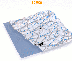 Places with similar names to Bouça, Portugal ::
Disclaimer :: Information on this page comes without warranty of any kind |
||
|
Where is Bouça? Elevation and coordinates ::
Latitude (lat): 41°48'0"N Longitude (lon): 8°29'0"W
Elevation (approx.): 55m (map arrows pan, magnifying glasses zoom) |
||
|
Visiting Bouça? Hotel/Accommodation ::
Book a hotel in Bouça Travel Guide ::
Buy a travel guide for Portugal rental cars ::
car rental offers GPS waypoint ::
download a GPX waypoint (PoI) of Bouça for your GPS receiver
|
||