|
search place name
|
||
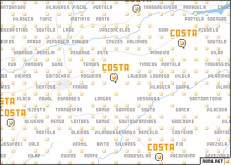
Costa (Braga, Portugal)Costa is a town in the Braga region of Portugal. An overview map of the region around Costa is displayed below.
regional and 3d topo map of Costa, Portugal ::
Costa airports ::
The nearest airport is OPO - Porto, located 43.5 km south west of Costa.
Other airports nearby include VRL - Vila Real (60.9 km south east), VGO - Vigo (79.1 km north), BGC - Braganca (140.9 km east), SCQ - Santiago (149.6 km north), Nearby towns ::
Aredes (1.9km south) //
Briteiros (1.9km south) //
Cachada (1.4km west) //
Pedregal (1.4km east) //
Espinho (1.4km west) //
Sobreposta (1.4km east) //
Este (2.3km north west) //
Bela Vista (2.3km north west) //
Cuvinho (3.7km south) //
Lajeosa (2.8km east) //
Codeçoza (2.8km east) //
Calçada (2.8km west) //
Nogueiro (2.8km west) //
Dadim (2.8km west) //
Senhora da Rocha (2.8km west) //
Eira Velha (4.0km south) //
Longos (4.0km south) //
Briteiros (4.0km south) //
Pedralva (3.3km north east) //
Tenões (3.3km north west) //
Barros (3.3km north west) //
Este (4.0km north) //
Briteiros (4.6km south east) //
Entre-as-Águas (4.6km south west) //
Balbeira (4.6km north west) //
Pontes (5.6km south) //
Sande (5.6km south) //
Sobreiro (5.6km south) //
Gaias (5.6km south) //
[all distances 'as the bird flies' and approximate] 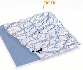 Places with similar names to Costa, Portugal ::
Disclaimer :: Information on this page comes without warranty of any kind |
||
|
Where is Costa? Elevation and coordinates ::
Latitude (lat): 41°33'0"N Longitude (lon): 8°21'0"W
Elevation (approx.): 419m (map arrows pan, magnifying glasses zoom) |
||
|
Visiting Costa? Hotel/Accommodation ::
Book a hotel in Costa Travel Guide ::
Buy a travel guide for Portugal rental cars ::
car rental offers GPS waypoint ::
download a GPX waypoint (PoI) of Costa for your GPS receiver
|
||