|
search place name
|
||
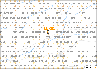
Febros (Braga, Portugal)Febros is a town in the Braga region of Portugal. An overview map of the region around Febros is displayed below.
regional and 3d topo map of Febros, Portugal ::
Febros airports ::
The nearest airport is OPO - Porto, located 44.7 km south west of Febros.
Other airports nearby include VGO - Vigo (69.6 km north), VRL - Vila Real (73.0 km south east), SCQ - Santiago (142.2 km north), BGC - Braganca (148.8 km east), Nearby towns ::
Laje (0.0km north) //
Fonte (0.0km north) //
Santiago (0.0km north) //
Moure (1.9km north) //
Penedos Altos (1.9km north) //
Goja (1.4km west) //
Oleiros (1.4km west) //
Cruz (1.4km east) //
Soutelo (1.4km east) //
Portelo (1.9km south) //
Estrada (1.9km south) //
Ponte (1.9km south) //
Prado (1.9km south) //
Vila Seca (2.3km north west) //
Ribeira (2.3km north west) //
Turiz (2.3km north east) //
Eidos (2.3km north east) //
Fontainha (2.3km south west) //
Burgueiros (2.3km south east) //
São Sebastião (2.8km west) //
Sampaio (2.8km east) //
Couto (2.8km east) //
Casal (2.8km east) //
Larim (2.8km east) //
Merelim (3.7km south) //
Carreiras (4.0km north) //
Atiães (3.3km north west) //
Freiriz (3.3km north west) //
Barbudo (4.0km north) //
[all distances 'as the bird flies' and approximate] 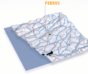 Places with similar names to Febros, Portugal ::
Disclaimer :: Information on this page comes without warranty of any kind |
||
|
Where is Febros? Elevation and coordinates ::
Latitude (lat): 41°37'0"N Longitude (lon): 8°28'0"W
Elevation (approx.): 50m (map arrows pan, magnifying glasses zoom) |
||
|
Visiting Febros? Hotel/Accommodation ::
Book a hotel in Febros Travel Guide ::
Buy a travel guide for Portugal rental cars ::
car rental offers GPS waypoint ::
download a GPX waypoint (PoI) of Febros for your GPS receiver
|
||