|
search place name
|
||
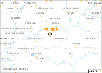
Felgar (Bragança, Portugal)Felgar is a town in the Bragança region of Portugal. An overview map of the region around Felgar is displayed below.
regional and 3d topo map of Felgar, Portugal ::
Felgar airports ::
The nearest airport is VRL - Vila Real, located 63.5 km west of Felgar.
Other airports nearby include BGC - Braganca (74.4 km north), SLM - Salamanca (126.5 km east), OPO - Porto (143.8 km west), VGO - Vigo (178.3 km north west), Nearby towns ::
Cilhade (1.9km north) //
Picões (4.0km north) //
Souto da Velha (3.3km south east) //
Cabreira (5.7km north) //
Larinho (4.6km south west) //
Santa Bárbara (4.6km south west) //
Ferradosa (5.7km north) //
Póvoa (5.9km west) //
Cardanha (6.7km north west) //
Gouveia (7.9km north) //
Felgueiras (8.5km south west) //
Sardão (9.3km north east) //
Mós (9.3km south east) //
[all distances 'as the bird flies' and approximate] 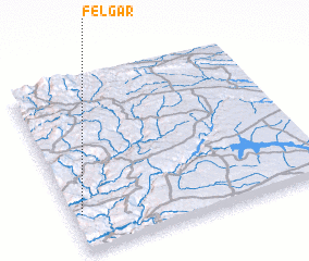 Places with similar names to Felgar, Portugal ::
// Velgur (RU)
// Valkaria (US)
// Felegara (IT)
// Folgaria (IT)
// Voulgáro (GR)
// Falagueira (PT)
// Falagueira (PT)
// Falagueiro (PT)
// Felgaria (PT)
// Felgueira (PT)
Disclaimer :: Information on this page comes without warranty of any kind |
||
|
Where is Felgar? Elevation and coordinates ::
Latitude (lat): 41°13'0"N Longitude (lon): 6°58'0"W
Elevation (approx.): 548m (map arrows pan, magnifying glasses zoom) |
||
|
Visiting Felgar? Hotel/Accommodation ::
Book a hotel in Felgar Travel Guide ::
Buy a travel guide for Portugal rental cars ::
car rental offers GPS waypoint ::
download a GPX waypoint (PoI) of Felgar for your GPS receiver
|
||