|
search place name
|
||
Fojo (Viana do Castelo, Portugal)Fojo is a town in the Viana do Castelo region of Portugal. An overview map of the region around Fojo is displayed below.
regional and 3d topo map of Fojo, Portugal ::

Fojo airports ::
The nearest airport is VGO - Vigo, located 51.7 km north of Fojo.
Other airports nearby include OPO - Porto (57.7 km south), VRL - Vila Real (94.9 km south east), SCQ - Santiago (127.0 km north), BGC - Braganca (161.8 km east), Nearby towns ::
Pregósa (NaNkm north) //
Pedreira (1.9km north) //
Estorãos (1.9km north) //
Bertiandos (1.4km east) //
Terra Feita (1.4km west) //
Souto (1.4km east) //
Moreira do Lima (2.3km north east) //
Fontão (2.3km south west) //
Arcos (2.3km south west) //
Toural (2.3km south west) //
Sá (2.8km east) //
Casaldeite (2.8km east) //
Cárcua (2.8km east) //
Balada (2.8km east) //
Galveias (2.8km east) //
Santa Comba (2.8km east) //
Barco (3.7km south) //
Regueira (3.7km south) //
Vitorino das Donas (3.7km south) //
Couto (3.3km north east) //
Canadelo (4.0km north) //
Trogal (3.3km south west) //
Santo Antão (3.3km south west) //
Gândara (3.3km south east) //
Anta (3.3km south east) //
Romão (4.0km south) //
Bouça Velha (4.0km south) //
Lanhezes (4.0km south) //
Pessegueiro (4.0km south) //
[all distances 'as the bird flies' and approximate] 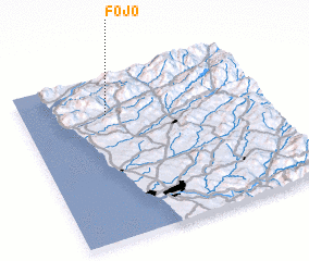 Places with similar names to Fojo, Portugal ::
Disclaimer :: Information on this page comes without warranty of any kind |
||
|
Where is Fojo? Elevation and coordinates ::
Latitude (lat): 41°46'0"N Longitude (lon): 8°39'0"W
Elevation (approx.): 22m (map arrows pan, magnifying glasses zoom) |
||
|
Visiting Fojo? Hotel/Accommodation ::
Book a hotel in Fojo Travel Guide ::
Buy a travel guide for Portugal rental cars ::
car rental offers GPS waypoint ::
download a GPX waypoint (PoI) of Fojo for your GPS receiver
|
||