|
search place name
|
||
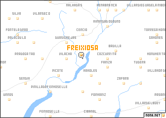
Freixiosa (Bragança, Portugal)Freixiosa is a town in the Bragança region of Portugal. An overview map of the region around Freixiosa is displayed below.
regional and 3d topo map of Freixiosa, Portugal ::
Freixiosa airports ::
The nearest airport is BGC - Braganca, located 57.3 km north west of Freixiosa.
Other airports nearby include SLM - Salamanca (86.8 km south east), VRL - Vila Real (118.8 km west), VLL - Valladolid (125.9 km east), Nearby towns ::
Vila Chã (2.8km west) //
Vila Chã de Braciosa (2.8km west) //
Mámoles (4.0km south) //
Duas Igrejas (4.6km north west) //
Cércio (5.6km north) //
Cozcurrita (4.2km east) //
Fariza (4.6km south east) //
Picote (5.6km south west) //
Palazuelo de Sayago (6.2km south east) //
Fornillos de Fermoselle (7.4km south) //
Badilla (5.9km east) //
Miranda do Douro (8.5km north east) //
Pinilla de Fermoselle (9.3km south west) //
[all distances 'as the bird flies' and approximate] 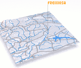 Places with similar names to Freixiosa, Portugal ::
Disclaimer :: Information on this page comes without warranty of any kind |
||
|
Where is Freixiosa? Elevation and coordinates ::
Latitude (lat): 41°26'0"N Longitude (lon): 6°19'0"W
Elevation (approx.): 712m (map arrows pan, magnifying glasses zoom) |
||
|
Visiting Freixiosa? Hotel/Accommodation ::
Book a hotel in Freixiosa Travel Guide ::
Buy a travel guide for Portugal rental cars ::
car rental offers GPS waypoint ::
download a GPX waypoint (PoI) of Freixiosa for your GPS receiver
|
||