|
search place name
|
||
Guedelhas (Beja, Portugal)Guedelhas is a town in the Beja region of Portugal. An overview map of the region around Guedelhas is displayed below.
regional and 3d topo map of Guedelhas, Portugal ::

Guedelhas airports ::
The nearest airport is FAO - Faro, located 52.1 km south of Guedelhas.
Other airports nearby include LIS - Lisbon Lisboa (176.0 km north west), BJZ - Badajoz Talavera La Real (186.5 km north east), XRY - Jerez (189.6 km south east), Nearby towns ::
Monte João Dias (1.9km south) //
Pereiro (2.4km north west) //
Gorazes (3.7km north) //
Viúvas (3.5km north east) //
Monte da Vinha (4.0km north) //
Dogueno (5.6km south) //
Telhada (5.8km south) //
Barranco de Belchior Dias (6.3km south west) //
Fornalha (7.4km south) //
Cumeadas (7.6km south) //
Monte das Mestras (6.2km west) //
Horta da Revesa (7.6km north) //
Monte do Romba (7.1km south east) //
Barrigão (7.0km north east) //
Sambrana (8.0km north) //
Santa Cruz (8.1km south east) //
Vale de Estacas (8.1km south west) //
[all distances 'as the bird flies' and approximate] 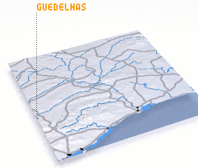 Places with similar names to Guedelhas, Portugal ::
// Ga-Tlhose (ZA)
Disclaimer :: Information on this page comes without warranty of any kind |
||
|
Where is Guedelhas? Elevation and coordinates ::
Latitude (lat): 37°29'0"N Longitude (lon): 7°59'0"W
Elevation (approx.): 295m (map arrows pan, magnifying glasses zoom) |
||
|
Visiting Guedelhas? Hotel/Accommodation ::
Book a hotel in Guedelhas Travel Guide ::
Buy a travel guide for Portugal rental cars ::
car rental offers GPS waypoint ::
download a GPX waypoint (PoI) of Guedelhas for your GPS receiver
|
||