|
search place name
|
||
Lagar de Baixo (Lisboa, Portugal)Lagar de Baixo is a town in the Lisboa region of Portugal. An overview map of the region around Lagar de Baixo is displayed below.
regional and 3d topo map of Lagar de Baixo, Portugal ::

Lagar de Baixo airports ::
The nearest airport is LIS - Lisbon Lisboa, located 26.9 km south east of Lagar de Baixo.
Other airports nearby include FAO - Faro (243.5 km south east), Nearby towns ::
Catrivana (0.0km north) //
Casal de Pianos (1.4km west) //
Almograve (1.4km east) //
A da Longa (1.4km east) //
Açafora (1.9km north) //
Cortesia (1.9km north) //
Bolembre de Baixo (2.3km south west) //
Magoito (2.3km south west) //
Tojeira (2.3km south west) //
Bolembre de Cima (2.3km south west) //
Azenha (2.3km south west) //
Sacário (2.3km south east) //
Alfaquiques (2.3km south east) //
São João das Lampas (2.3km south east) //
Bolelas (2.3km south east) //
Pernigem (3.7km south) //
Arneiro (3.7km south) //
Areias (2.9km east) //
Amoreira (2.9km east) //
Fontanelas (4.0km south) //
Barrateiras (4.0km south) //
Codeceira (4.0km south) //
Chelreira (4.0km south) //
Concelho (3.4km south east) //
Montarroio (3.4km south east) //
Cabeço da Moucheira (3.4km north east) //
Peroleite (3.4km north east) //
Faceira (4.0km north) //
Terrujem (4.7km south east) //
[all distances 'as the bird flies' and approximate] 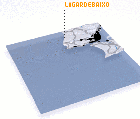 Places with similar names to Lagar de Baixo, Portugal ::
// Lugar de Baixo (PT)
Disclaimer :: Information on this page comes without warranty of any kind |
||
|
Where is Lagar de Baixo? Elevation and coordinates ::
Latitude (lat): 38°53'0"N Longitude (lon): 9°25'0"W
Elevation (approx.): 95m (map arrows pan, magnifying glasses zoom) |
||
|
Visiting Lagar de Baixo? Hotel/Accommodation ::
Book a hotel in Lagar de Baixo Travel Guide ::
Buy a travel guide for Portugal rental cars ::
car rental offers GPS waypoint ::
download a GPX waypoint (PoI) of Lagar de Baixo for your GPS receiver
|
||