|
search place name
|
||
Lagielas (Porto, Portugal)Lagielas is a town in the Porto region of Portugal. An overview map of the region around Lagielas is displayed below.
regional and 3d topo map of Lagielas, Portugal ::

Lagielas airports ::
The nearest airport is OPO - Porto, located 2.1 km south of Lagielas.
Other airports nearby include VRL - Vila Real (80.7 km east), VGO - Vigo (107.3 km north), BGC - Braganca (177.4 km east), SCQ - Santiago (182.4 km north), Nearby towns ::
Aveleda (NaNkm north) //
Vilar do Pinheiro (1.4km east) //
Vareiros (1.4km west) //
Vilar do Senhor (1.9km south) //
Prozela (1.9km south) //
Mosteiró (2.3km north east) //
Vilar (2.3km north east) //
Labruge (2.3km north west) //
Vila Nova de Telha (2.3km south east) //
Rio da Mina (2.3km south east) //
Avilhoso (2.3km south west) //
Cabanelas (2.3km south west) //
Joudina (3.7km north) //
Gemunde (2.8km east) //
Carvalhido (2.8km east) //
Angeiras (2.8km west) //
Calvelhe (2.8km west) //
Malta (4.0km north) //
Arões (3.3km north east) //
Modivas (4.0km north) //
Padrão (3.3km south east) //
Monte das Pedras (4.0km south) //
Pedras Rubras (4.0km south) //
Lavra (3.3km south west) //
Parteira (4.0km south) //
Lavandeira (4.6km north west) //
Rio da Gândara (4.6km north west) //
Moreira (4.6km south east) //
Pampelido Novo (4.6km south west) //
[all distances 'as the bird flies' and approximate] 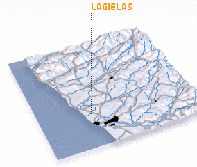 Places with similar names to Lagielas, Portugal ::
// Lajuelas (CL)
Disclaimer :: Information on this page comes without warranty of any kind |
||
|
Where is Lagielas? Elevation and coordinates ::
Latitude (lat): 41°16'0"N Longitude (lon): 8°41'0"W
Elevation (approx.): 31m (map arrows pan, magnifying glasses zoom) |
||
|
Visiting Lagielas? Hotel/Accommodation ::
Book a hotel in Lagielas Travel Guide ::
Buy a travel guide for Portugal rental cars ::
car rental offers GPS waypoint ::
download a GPX waypoint (PoI) of Lagielas for your GPS receiver
|
||