|
search place name
|
||
Martim (Bragança, Portugal)Martim is a town in the Bragança region of Portugal. An overview map of the region around Martim is displayed below.
regional and 3d topo map of Martim, Portugal ::

Martim airports ::
The nearest airport is BGC - Braganca, located 18.9 km north east of Martim.
Other airports nearby include VRL - Vila Real (87.6 km south west), SLM - Salamanca (145.7 km south east), VGO - Vigo (154.1 km west), OPO - Porto (160.1 km west), Nearby towns ::
Carrazedo (2.3km north west) //
Refoios (2.3km south west) //
Zoio (2.8km west) //
São Cibrão (4.0km south) //
Celas (4.6km south west) //
Alimonde (5.6km north) //
Fontes (6.2km north east) //
Lanção (6.2km south east) //
Formil (5.6km north east) //
Melhe (5.5km west) //
Rebordãos (5.8km east) //
Nogueira (5.8km east) //
Conlelas (7.5km north) //
Vilar de Ouro (7.5km south) //
São Roque (6.9km north west) //
Vila Boa de Ousilhão (6.9km north west) //
Vidoedo (6.9km south east) //
Sortes (6.9km south east) //
Castanheira (6.7km north east) //
Gostei (6.7km north east) //
Ousilhão (6.7km north west) //
Fontão (6.7km north west) //
Mós de Celas (7.8km south west) //
Grandais (9.2km north east) //
[all distances 'as the bird flies' and approximate] 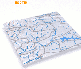 Places with similar names to Martim, Portugal ::
Disclaimer :: Information on this page comes without warranty of any kind |
||
|
Where is Martim? Elevation and coordinates ::
Latitude (lat): 41°45'0"N Longitude (lon): 6°53'0"W
Elevation (approx.): 1070m (map arrows pan, magnifying glasses zoom) |
||
|
Visiting Martim? Hotel/Accommodation ::
Book a hotel in Martim Travel Guide ::
Buy a travel guide for Portugal rental cars ::
car rental offers GPS waypoint ::
download a GPX waypoint (PoI) of Martim for your GPS receiver
|
||