|
search place name
|
||
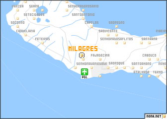
Milagres (Açores, Portugal)Milagres is a town in the Açores region of Portugal. An overview map of the region around Milagres is displayed below.
regional and 3d topo map of Milagres, Portugal ::
Milagres airports ::
The nearest airport is PDL - Ponta Delgada, located 2.8 km south of Milagres.
Other airports nearby include SMA - Santa Maria (island) Santa Maria (99.9 km south east), TER - Lajes (terceira Island) Lajes (164.4 km north west), Nearby towns ::
Senhora da Saúde (0.0km north) //
Arrifes (0.0km north) //
Ramalho (2.4km south east) //
Senhora da Piedade (2.4km south east) //
Relva (2.4km south west) //
Fajã de Cima (2.9km east) //
Ponta Delgada (4.7km south east) //
Fajã de Baixo (4.8km south east) //
Belém (4.8km south east) //
Rosto de Cão (4.8km south east) //
Capelas (7.6km north) //
São Roque (6.1km east) //
São Vicente (7.1km north east) //
Senhora dos Aflitos (6.9km north east) //
Fenais da Luz (8.1km north east) //
Farroupo (8.1km north east) //
São Pedro (9.4km north east) //
[all distances 'as the bird flies' and approximate] 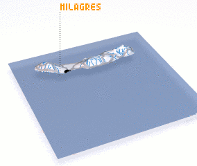 Places with similar names to Milagres, Portugal ::
// Melkers (DE)
// Milagres (PT)
// Milagres (PT)
// Milagros (CU)
// Malyye Karasi (RU)
// Malyye Karzi (RU)
// Milagrosa (CO)
// Milagros (EC)
// Milagros (MX)
// Malagarasi (TZ)
Disclaimer :: Information on this page comes without warranty of any kind |
||
|
Where is Milagres? Elevation and coordinates ::
Latitude (lat): 37°46'0"N Longitude (lon): 25°42'0"W
Elevation (approx.): 193m (map arrows pan, magnifying glasses zoom) |
||
|
Visiting Milagres? Hotel/Accommodation ::
Book a hotel in Milagres Travel Guide ::
Buy a travel guide for Portugal rental cars ::
car rental offers GPS waypoint ::
download a GPX waypoint (PoI) of Milagres for your GPS receiver
|
||