|
search place name
|
||
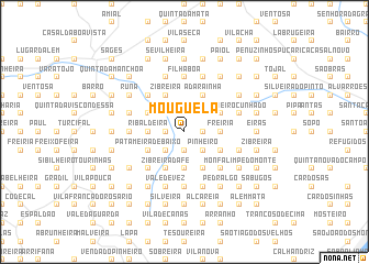
Mouguela (Lisboa, Portugal)Mouguela is a town in the Lisboa region of Portugal. An overview map of the region around Mouguela is displayed below.
regional and 3d topo map of Mouguela, Portugal ::
Mouguela airports ::
The nearest airport is LIS - Lisbon Lisboa, located 28.1 km south of Mouguela.
Nearby towns ::
Dois Portos (1.4km west) //
Barqueira (1.9km south) //
Ribeira Maria Afonso (1.9km north) //
Boligueira (1.9km north) //
Murteira (1.9km north) //
Folgorosa (1.4km east) //
Feliteira (2.3km south west) //
Granja (2.3km south west) //
Sirol (2.3km north west) //
Quinta Curvaceira (2.3km north west) //
Quinta da Conceição (2.3km north west) //
Sobral de Monte Agraço (2.3km south east) //
Outeiro (2.3km south east) //
Pinheiro (2.3km south east) //
Alfeiria (2.3km north east) //
Maceira (2.3km north east) //
Ribaldeira (2.9km west) //
Pedreira (3.7km south) //
Cabeda (3.7km south) //
Marvões (3.7km south) //
Freiria (2.9km east) //
Chões (2.9km east) //
Patameira de Baixo (3.4km south west) //
Zibreira da Fé (4.0km south) //
Gosundeira (4.0km south) //
Caixaria (3.4km north west) //
São Quintino (4.0km south) //
Almargem (4.0km south) //
Seramena (4.0km south) //
[all distances 'as the bird flies' and approximate]  Places with similar names to Mouguela, Portugal ::
Disclaimer :: Information on this page comes without warranty of any kind |
||
|
Where is Mouguela? Elevation and coordinates ::
Latitude (lat): 39°2'0"N Longitude (lon): 9°10'0"W
Elevation (approx.): 145m (map arrows pan, magnifying glasses zoom) |
||
|
Visiting Mouguela? Hotel/Accommodation ::
Book a hotel in Mouguela Travel Guide ::
Buy a travel guide for Portugal rental cars ::
car rental offers GPS waypoint ::
download a GPX waypoint (PoI) of Mouguela for your GPS receiver
|
||