|
search place name
|
||
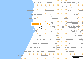
Paul de Cima (Lisboa, Portugal)Paul de Cima is a town in the Lisboa region of Portugal. An overview map of the region around Paul de Cima is displayed below.
regional and 3d topo map of Paul de Cima, Portugal ::
Paul de Cima airports ::
The nearest airport is LIS - Lisbon Lisboa, located 28.5 km south east of Paul de Cima.
Other airports nearby include FAO - Faro (248.3 km south east), Nearby towns ::
Zambujal (0.0km north) //
Casas Velhas (0.0km north) //
Casa da Serra (1.4km east) //
Relvas (1.4km east) //
Regueirão (1.9km north) //
Arrebenta (1.9km north) //
Casalinho (1.4km west) //
Fonte Boa da Abrincoza (1.4km west) //
Lapa da Serra (1.4km west) //
Urzal (1.9km south) //
Caeiros (2.3km north east) //
Amendoeira (2.3km north east) //
Godel (2.3km south east) //
Montesouros (2.3km south east) //
Seixal (2.3km north west) //
Casa do Cordeiro (2.3km north west) //
Casa do Barril (2.3km north west) //
Fonte Boa dos Nabos (2.3km north west) //
Barril de Cima (2.3km south west) //
Carvoeira (2.3km south west) //
Baleia (2.3km south west) //
Bairro Alto (3.7km north) //
Junqueiros (3.7km north) //
Seixal (3.7km south) //
Arneiro da Arreganha (3.7km south) //
Cerradas (3.7km south) //
Moucheira (3.7km south) //
Pobral (3.7km south) //
Foz (2.9km west) //
[all distances 'as the bird flies' and approximate]  Places with similar names to Paul de Cima, Portugal ::
// Paul de Cima (PT)
// Põltsamaa (EE)
Disclaimer :: Information on this page comes without warranty of any kind |
||
|
Where is Paul de Cima? Elevation and coordinates ::
Latitude (lat): 38°57'0"N Longitude (lon): 9°23'0"W
Elevation (approx.): 114m (map arrows pan, magnifying glasses zoom) |
||
|
Visiting Paul de Cima? Hotel/Accommodation ::
Book a hotel in Paul de Cima Travel Guide ::
Buy a travel guide for Portugal rental cars ::
car rental offers GPS waypoint ::
download a GPX waypoint (PoI) of Paul de Cima for your GPS receiver
|
||