|
search place name
|
||
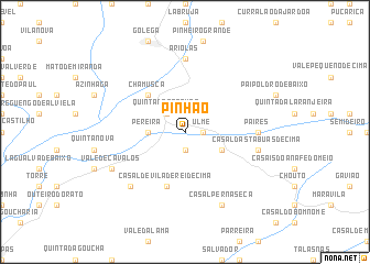
Pinhão (Santarém, Portugal)Pinhão is a town in the Santarém region of Portugal. An overview map of the region around Pinhão is displayed below.
regional and 3d topo map of Pinhão, Portugal ::
Pinhão airports ::
The nearest airport is LIS - Lisbon Lisboa, located 84.0 km south west of Pinhão.
Other airports nearby include BJZ - Badajoz Talavera La Real (148.6 km east), OPO - Porto (215.4 km north), VRL - Vila Real (226.1 km north), Nearby towns ::
Ulme (1.4km east) //
Santa Marta (1.4km east) //
Casal do Crespo (1.9km south) //
Carregal (2.3km north west) //
Quinta das Trevas (2.3km north west) //
Pereira (2.9km west) //
Murta (2.9km west) //
Casal do Junco de Baixo (3.4km south east) //
Chamusca (4.7km north west) //
Casal de Vila de Rei de Cima (5.7km south) //
Ariolas (7.4km north) //
Quinta da Arresima (7.4km north) //
Quinta dos Arneiros (7.4km north) //
Balsas (5.7km east) //
Paires (5.7km east) //
Casal das Tábuas de Cima (6.0km east) //
Casal de Vale de Carros (7.0km south west) //
Casal Perna Seca (7.9km south) //
Vale de Cavalos (6.8km south west) //
[all distances 'as the bird flies' and approximate]  Places with similar names to Pinhão, Portugal ::
Disclaimer :: Information on this page comes without warranty of any kind |
||
|
Where is Pinhão? Elevation and coordinates ::
Latitude (lat): 39°19'0"N Longitude (lon): 8°27'0"W
Elevation (approx.): 35m (map arrows pan, magnifying glasses zoom) |
||
|
Visiting Pinhão? Hotel/Accommodation ::
Book a hotel in Pinhão Travel Guide ::
Buy a travel guide for Portugal rental cars ::
car rental offers GPS waypoint ::
download a GPX waypoint (PoI) of Pinhão for your GPS receiver
|
||