|
search place name
|
||
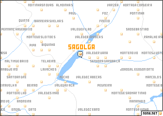
Sagolga (Portalegre, Portugal)Sagolga is a town in the Portalegre region of Portugal. An overview map of the region around Sagolga is displayed below.
regional and 3d topo map of Sagolga, Portugal ::
Sagolga airports ::
The nearest airport is LIS - Lisbon Lisboa, located 95.2 km west of Sagolga.
Other airports nearby include BJZ - Badajoz Talavera La Real (114.6 km east), Nearby towns ::
Embarbez (1.4km east) //
Montalvo (2.3km north west) //
Vale de Ruana (2.9km east) //
Vale de Barrocas (4.0km north) //
Montinho das Cabanas (4.0km north) //
Morenos (3.4km south east) //
Vale de Vilão (5.6km north) //
Monte da Vinha (4.3km east) //
Senhora da Rabaça (4.7km south east) //
Montargil (4.7km south west) //
Vale de Cabeças (5.7km south) //
Courelas (5.7km south west) //
Mocho (6.3km south west) //
Porto de Santarém (6.3km north east) //
Telheiro (6.0km west) //
Biquinha (6.0km west) //
Lavachos (6.8km south west) //
Vale da Vaca (8.0km south) //
Foros da Salgueira (8.0km north) //
Freixo (8.6km north east) //
Cansado (8.6km north east) //
Pedreira (8.6km south east) //
Barreiras Novas (8.6km north west) //
Amieira (8.6km south west) //
Barreiras Velhas (9.4km north west) //
[all distances 'as the bird flies' and approximate]  Places with similar names to Sagolga, Portugal ::
Disclaimer :: Information on this page comes without warranty of any kind |
||
|
Where is Sagolga? Elevation and coordinates ::
Latitude (lat): 39°6'0"N Longitude (lon): 8°7'0"W
Elevation (approx.): 81m (map arrows pan, magnifying glasses zoom) |
||
|
Visiting Sagolga? Hotel/Accommodation ::
Book a hotel in Sagolga Travel Guide ::
Buy a travel guide for Portugal rental cars ::
car rental offers GPS waypoint ::
download a GPX waypoint (PoI) of Sagolga for your GPS receiver
|
||