|
search place name
|
||
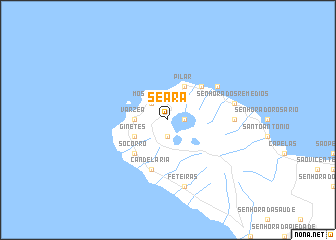
Seara (Açores, Portugal)Seara is a town in the Açores region of Portugal. An overview map of the region around Seara is displayed below.
regional and 3d topo map of Seara, Portugal ::
Seara airports ::
The nearest airport is PDL - Ponta Delgada, located 16.6 km south east of Seara.
Other airports nearby include SMA - Santa Maria (island) Santa Maria (113.9 km south east), TER - Lajes (terceira Island) Lajes (150.4 km north west), Nearby towns ::
Cerrado das Ereiras (1.5km east) //
Sete Cidades (1.9km south) //
Mosteiros (2.4km north west) //
Várzea (2.9km west) //
Pilar (4.0km north) //
Ginetes (3.5km south west) //
Bretanha (4.7km north east) //
Senhora dʼAjuda (4.7km north east) //
Amoreiras (4.7km north east) //
Socorro (4.7km south west) //
Candelária (5.7km south) //
Lomba da Cruz (5.7km south) //
Pico Vermelho (5.7km north east) //
Santa Bárbara (5.9km east) //
Senhora dos Remédios (6.1km east) //
Feteiras (7.6km south) //
[all distances 'as the bird flies' and approximate] 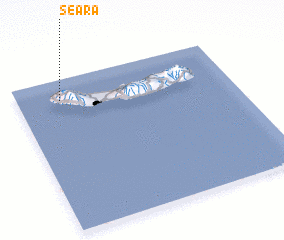 Places with similar names to Seara, Portugal ::
Disclaimer :: Information on this page comes without warranty of any kind |
||
|
Where is Seara? Elevation and coordinates ::
Latitude (lat): 37°52'0"N Longitude (lon): 25°48'0"W
Elevation (approx.): 431m (map arrows pan, magnifying glasses zoom) |
||
|
Visiting Seara? Hotel/Accommodation ::
Book a hotel in Seara Travel Guide ::
Buy a travel guide for Portugal rental cars ::
car rental offers GPS waypoint ::
download a GPX waypoint (PoI) of Seara for your GPS receiver
|
||