|
search place name
|
||
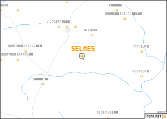
Selmes (Beja, Portugal)Selmes is a town in the Beja region of Portugal. An overview map of the region around Selmes is displayed below.
regional and 3d topo map of Selmes, Portugal ::
Selmes airports ::
The nearest airport is BJZ - Badajoz Talavera La Real, located 116.5 km north east of Selmes.
Other airports nearby include FAO - Faro (127.3 km south), LIS - Lisbon Lisboa (138.5 km north west), SVQ - Sevilla (183.9 km south east), XRY - Jerez (217.1 km south east), Nearby towns ::
Alcaria (5.7km north) //
Quinta das Relíquias (7.6km north) //
Quinta de São Lázaro (7.6km north) //
Vidigueira (8.0km north) //
Vila de Frades (8.6km north west) //
[all distances 'as the bird flies' and approximate]  Places with similar names to Selmes, Portugal ::
// Zela Āmbesa (ER)
// Zell am Moos (AT)
// Zell am See (AT)
// Solms (DE)
// Salamís (GR)
// Solomós (GR)
// Salemas (PT)
// Sulmice (PL)
// Złe Mięso (PL)
// Selymes (HU)
Disclaimer :: Information on this page comes without warranty of any kind |
||
|
Where is Selmes? Elevation and coordinates ::
Latitude (lat): 38°9'0"N Longitude (lon): 7°46'0"W
Elevation (approx.): 136m (map arrows pan, magnifying glasses zoom) |
||
|
Visiting Selmes? Hotel/Accommodation ::
Book a hotel in Selmes Travel Guide ::
Buy a travel guide for Portugal rental cars ::
car rental offers GPS waypoint ::
download a GPX waypoint (PoI) of Selmes for your GPS receiver
|
||