|
search place name
|
||
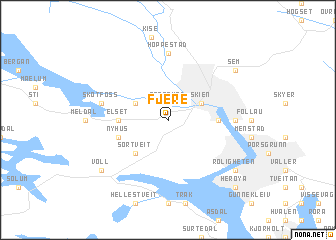
Fjere (Telemark, Norway)Fjere is a town in the Telemark region of Norway. An overview map of the region around Fjere is displayed below.
regional and 3d topo map of Fjere, Norway ::
Fjere airports ::
The nearest airport is SKE - Skien Geiteryggen, located 0.2 km north of Fjere.
Other airports nearby include TRF - Torp (39.6 km east), KRS - Kristiansand Kjevik (138.8 km south west), OSL - Oslo Gardermoen (141.9 km north east), VDB - Fagernes Leirin (204.7 km north), Nearby towns ::
Grotsund (1.9km north) //
Skien (2.7km north east) //
Åfoss (2.7km north west) //
Sørtveit (4.2km south west) //
Eikonrød (2.8km east) //
Elset (2.8km west) //
Nyhus (3.4km south west) //
Bøle (3.8km east) //
Fossom (7.4km north) //
Hoppestad (7.4km north) //
Skotfoss (4.2km north west) //
Sem (6.7km north east) //
Roligheten (6.7km south east) //
Voll (6.7km south west) //
Herøya (8.3km south east) //
[all distances 'as the bird flies' and approximate] 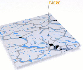 Places with similar names to Fjere, Norway ::
Disclaimer :: Information on this page comes without warranty of any kind |
||
|
Where is Fjere? Elevation and coordinates ::
Latitude (lat): 59°11'0"N Longitude (lon): 9°34'0"E
Elevation (approx.): 132m (map arrows pan, magnifying glasses zoom) |
||
|
Visiting Fjere? Hotel/Accommodation ::
Book a hotel in Fjere Travel Guide ::
Buy a travel guide for Norway rental cars ::
car rental offers GPS waypoint ::
download a GPX waypoint (PoI) of Fjere for your GPS receiver
|
||