|
search place name
|
||
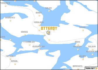
Otterøy (Nord-Trøndelag, Norway)Otterøy is a town in the Nord-Trøndelag region of Norway. An overview map of the region around Otterøy is displayed below.
regional and 3d topo map of Otterøy, Norway ::
Otterøy airports ::
The nearest airport is BNN - Bronnoysund Bronnoy, located 113.9 km north of Otterøy.
Other airports nearby include TRD - Trondheim Vaernes (119.5 km south), OLA - Orland (123.1 km south west), MJF - Mosjoen Kjaerstad (167.4 km north east), SSJ - Sandnessjoen Stokka (169.6 km north), Nearby towns ::
Skomsvoll (0.8km west) //
Broem (1.9km south) //
Husvik (2.0km north east) //
Fosslandsosen (2.4km north west) //
Fossland (4.0km north west) //
Indre Hoddøy (5.8km south) //
Årnes (7.6km north) //
Ytre Hoddøy (4.9km south west) //
[all distances 'as the bird flies' and approximate] 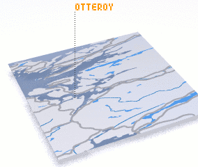 Places with similar names to Otterøy, Norway ::
Disclaimer :: Information on this page comes without warranty of any kind |
||
|
Where is Otterøy? Elevation and coordinates ::
Latitude (lat): 64°31'0"N Longitude (lon): 11°18'0"E
(map arrows pan, magnifying glasses zoom) |
||
|
Visiting Otterøy? Hotel/Accommodation ::
Book a hotel in Otterøy Travel Guide ::
Buy a travel guide for Norway rental cars ::
car rental offers GPS waypoint ::
download a GPX waypoint (PoI) of Otterøy for your GPS receiver
|
||