|
search place name
|
||
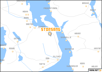
Storsand (Buskerud, Norway)Storsand is a town in the Buskerud region of Norway. An overview map of the region around Storsand is displayed below.
regional and 3d topo map of Storsand, Norway ::
Storsand airports ::
The nearest airport is TRF - Torp, located 55.2 km south of Storsand.
Other airports nearby include OSL - Oslo Gardermoen (66.7 km north east), SKE - Skien Geiteryggen (78.1 km south west), VDB - Fagernes Leirin (168.2 km north west), THN - Trollhattan Vanersborg (179.5 km south east), Nearby towns ::
Husvik (2.8km north east) //
Verpen (2.8km north west) //
Drøbak (2.4km north east) //
Skiphelle (3.3km south east) //
Engene (4.3km north west) //
Sætre (5.1km north west) //
Filtvet (8.8km south) //
Hvitsten (6.9km south east) //
Båtstø (9.1km north west) //
[all distances 'as the bird flies' and approximate]  Places with similar names to Storsand, Norway ::
// Storasund (NO)
// Storesunde (NO)
// Sattār Sānd (PK)
// Södersund (SE)
// Södersunda (SE)
// Stora Sund (SE)
// Storsand (SE)
// Storsand (SE)
// Storsand (SE)
// Storsand (SE)
Disclaimer :: Information on this page comes without warranty of any kind |
||
|
Where is Storsand? Elevation and coordinates ::
Latitude (lat): 59°39'7"N Longitude (lon): 10°35'38"E
Elevation (approx.): 109m (map arrows pan, magnifying glasses zoom) |
||
|
Visiting Storsand? Hotel/Accommodation ::
Book a hotel in Storsand Travel Guide ::
Buy a travel guide for Norway rental cars ::
car rental offers GPS waypoint ::
download a GPX waypoint (PoI) of Storsand for your GPS receiver
|
||