|
search place name
|
||
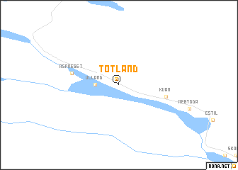
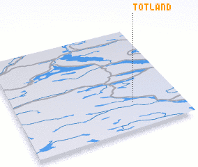
Totland (Nord-Trøndelag, Norway)Totland is a town in the Nord-Trøndelag region of Norway. An overview map of the region around Totland is displayed below.
regional and 3d topo map of Totland, Norway ::
Totland airports ::
The nearest airport is OSD - Ostersund Froson, located 125.7 km south of Totland.
Other airports nearby include BNN - Bronnoysund Bronnoy (150.9 km north west), MJF - Mosjoen Kjaerstad (170.8 km north), SSJ - Sandnessjoen Stokka (197.3 km north), Nearby towns ::
 Places with similar names to Totland, Norway ::
// Datto Lantoy (PH)
// Dateland (US)
// Totland (NO)
// Totland (NO)
// Totland (NO)
// Dital Lund (PK)
// Dittu Lund (PK)
// Tadlount (MA)
// Totland (GB)
// Tudelândia (BR)
Disclaimer :: Information on this page comes without warranty of any kind |
||
|
Where is Totland? Elevation and coordinates ::
Latitude (lat): 64°16'0"N Longitude (lon): 13°43'0"E
(map arrows pan, magnifying glasses zoom) |
||
|
Visiting Totland? Hotel/Accommodation ::
Book a hotel in Totland Travel Guide ::
Buy a travel guide for Norway rental cars ::
car rental offers GPS waypoint ::
download a GPX waypoint (PoI) of Totland for your GPS receiver
|
||