|
search place name
|
||
Vingsand (Sør-Trøndelag, Norway)Vingsand is a town in the Sør-Trøndelag region of Norway. An overview map of the region around Vingsand is displayed below.
regional and 3d topo map of Vingsand, Norway ::

Vingsand airports ::
The nearest airport is OLA - Orland, located 83.9 km south west of Vingsand.
Other airports nearby include TRD - Trondheim Vaernes (102.0 km south), BNN - Bronnoysund Bronnoy (149.0 km north east), RRS - Roros (202.2 km south), Nearby towns ::
Sandvikberget (2.0km south west) //
Strand (3.7km south) //
Hopen (1.6km east) //
Aunet (3.0km south west) //
Myra (4.4km south east) //
Sætervika (5.8km north) //
Sætran (7.9km south) //
Brattjær (7.6km south) //
Sørgjer (7.8km south) //
Angen (6.6km north east) //
[all distances 'as the bird flies' and approximate] 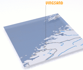 Places with similar names to Vingsand, Norway ::
// Vính Xuận (3) (VN)
// Vångsunda (SE)
Disclaimer :: Information on this page comes without warranty of any kind |
||
|
Where is Vingsand? Elevation and coordinates ::
Latitude (lat): 64°21'0"N Longitude (lon): 10°28'0"E
(map arrows pan, magnifying glasses zoom) |
||
|
Visiting Vingsand? Hotel/Accommodation ::
Book a hotel in Vingsand Travel Guide ::
Buy a travel guide for Norway rental cars ::
car rental offers GPS waypoint ::
download a GPX waypoint (PoI) of Vingsand for your GPS receiver
|
||