|
search place name
|
||
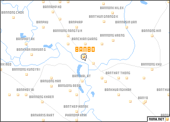
Ban Bo (Yasothon, Thailand)Ban Bo is a town in the Yasothon region of Thailand. An overview map of the region around Ban Bo is displayed below.
regional and 3d topo map of Ban Bo, Thailand ::
Ban Bo airports ::
The nearest airport is ZVK - Savannakhet, located 107.2 km north east of Ban Bo.
Other airports nearby include SNO - Sakon Nakhon (154.4 km north), PKZ - Pakse (191.7 km south east), UTH - Udon Thani (226.8 km north west), Nearby towns ::
Ban Samran (1.9km north) //
Yasothon (1.8km east) //
Ban Chiang Wang (3.7km north) //
Ban Tha Lat (4.4km south) //
Ban Bak (5.1km north west) //
Ban Kham Mek (5.1km north east) //
Ban Sala Daeng (5.1km south east) //
Ban Kwang (6.3km south east) //
Ban Nong Nang Tum (6.6km north west) //
Ban Don Daeng (7.2km south west) //
Ban Phap (7.6km north) //
Ban Nong Luang (7.6km south) //
Ban Nong Waeng (7.5km north east) //
Ban Kut Nam Sai Tai (8.0km south west) //
Ban That Thong (8.0km south east) //
Ban Dong Man (9.0km south west) //
Ban Thung Nang Ok (9.5km north east) //
Ban Khuang Kham (10.3km south east) //
[all distances 'as the bird flies' and approximate] 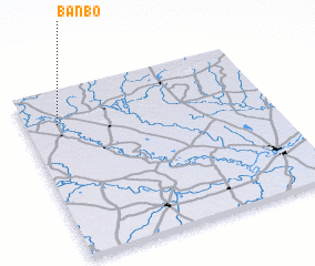 Places with similar names to Ban Bo, Thailand ::
Disclaimer :: Information on this page comes without warranty of any kind |
||
|
Where is Ban Bo? Elevation and coordinates ::
Latitude (lat): 15°48'0"N Longitude (lon): 104°8'0"E
Elevation (approx.): 128m (map arrows pan, magnifying glasses zoom) |
||
|
Visiting Ban Bo? Hotel/Accommodation ::
Book a hotel in Ban Bo Travel Guide ::
Buy a travel guide for Thailand rental cars ::
car rental offers GPS waypoint ::
download a GPX waypoint (PoI) of Ban Bo for your GPS receiver
|
||