|
search place name
|
||
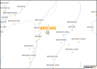
Ban Chae (Lampang, Thailand)Ban Chae is a town in the Lampang region of Thailand. An overview map of the region around Ban Chae is displayed below.
regional and 3d topo map of Ban Chae, Thailand ::
Ban Chae airports ::
The nearest airport is LPT - Lampang, located 32.0 km south west of Ban Chae.
Other airports nearby include PRH - Phrae (49.0 km south east), PHS - Phitsanulok (184.8 km south), LOE - Loei (230.5 km south east), Nearby towns ::
Ban Huai Fai Lai Thung (3.5km west) //
Ban Na Khu (3.7km north) //
Ban Dong (3.9km north west) //
Ban Hua Thung (4.0km south west) //
Ban Mon (4.0km south west) //
Ban Mo Luang (5.2km south west) //
Ban Sop Chang (5.3km east) //
Ban Tha Si (5.6km north west) //
Ban Sop Mam (5.8km south east) //
Ban Kham (7.6km south west) //
Ban Na Sak (8.4km south east) //
Ban Pu Thun (8.7km south west) //
Ban Na Pom (9.0km south west) //
[all distances 'as the bird flies' and approximate]  Places with similar names to Ban Chae, Thailand ::
// Ben Aouich (MA)
// Beni Aïchi (MA)
// Benicia (US)
// Bench (US)
// Ban Ao Cho (TH)
// Ban Chai (TH)
// Ban Chi (TH)
// Ban Chia (TH)
// Ban Chia (TH)
// Ban Cho (TH)
Disclaimer :: Information on this page comes without warranty of any kind |
||
|
Where is Ban Chae? Elevation and coordinates ::
Latitude (lat): 18°23'0"N Longitude (lon): 99°47'0"E
Elevation (approx.): 455m (map arrows pan, magnifying glasses zoom) |
||
|
Visiting Ban Chae? Hotel/Accommodation ::
Book a hotel in Ban Chae Travel Guide ::
Buy a travel guide for Thailand rental cars ::
car rental offers GPS waypoint ::
download a GPX waypoint (PoI) of Ban Chae for your GPS receiver
|
||