|
search place name
|
||
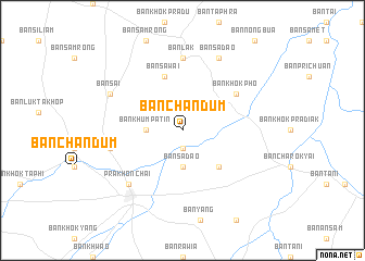
Ban Chan Dum (Buriram, Thailand)Ban Chan Dum is a town in the Buriram region of Thailand. An overview map of the region around Ban Chan Dum is displayed below.
regional and 3d topo map of Ban Chan Dum, Thailand ::
Ban Chan Dum airports ::
The nearest airport is NAK - Nakhon Ratchasima Khorat, located 117.3 km west of Ban Chan Dum.
Other airports nearby include REP - Siem-reap Siem Reap (157.2 km south east), ZVK - Savannakhet (272.3 km north east), Nearby towns ::
Ban Tabaek (1.9km south) //
Ban Khum Patin (3.6km west) //
Ban Sadao (3.7km south) //
Ban Khok Takhian (3.7km south) //
Ban Khok Chum (5.2km south east) //
Ban Sawai (5.8km north) //
Ban Khok Pho (6.5km north east) //
Ban Lak (7.4km north) //
Ban Chabian (7.4km west) //
Prakhon Chai (7.7km south west) //
Ban Sai (8.1km north west) //
Ban Sadao (8.2km north east) //
[all distances 'as the bird flies' and approximate]  Places with similar names to Ban Chan Dum, Thailand ::
Disclaimer :: Information on this page comes without warranty of any kind |
||
|
Where is Ban Chan Dum? Elevation and coordinates ::
Latitude (lat): 14°40'0"N Longitude (lon): 103°8'0"E
Elevation (approx.): 156m (map arrows pan, magnifying glasses zoom) |
||
|
Visiting Ban Chan Dum? Hotel/Accommodation ::
Book a hotel in Ban Chan Dum Travel Guide ::
Buy a travel guide for Thailand rental cars ::
car rental offers GPS waypoint ::
download a GPX waypoint (PoI) of Ban Chan Dum for your GPS receiver
|
||