|
search place name
|
||
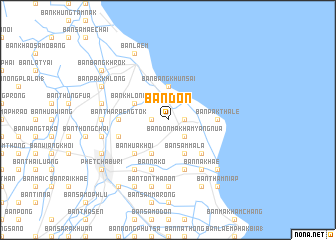
Ban Don (Phetchaburi, Thailand)Ban Don is a town in the Phetchaburi region of Thailand. An overview map of the region around Ban Don is displayed below.
regional and 3d topo map of Ban Don, Thailand ::
Ban Don airports ::
The nearest airport is HHQ - Prachuap Khiri Khan Hua Hin, located 57.3 km south of Ban Don.
Other airports nearby include BKK - Bangkok Intl (105.8 km north east), UTP - Rayong U Taphao Intl (119.2 km south east), MGZ - Myeik (170.6 km south west), Nearby towns ::
Ban Don Phung Dat (1.8km east) //
Ban Don Phung Dat (1.8km east) //
Ban Pa Khat (1.8km west) //
Ban Don Makham Yang Nua (2.6km south east) //
Ban Bang Khun Sai (3.7km north) //
Ban Sammala (4.1km south east) //
Ban Don Het (4.1km south east) //
Ban Bang Chan (4.1km south west) //
Ban Phi Liang (1) (4.1km south west) //
Ban Khlong Laem (4.1km north west) //
Ban Khlong Mon (4.1km north west) //
Ban Chong Khaep (5.2km south east) //
Ban Don Makham Sung (5.2km south east) //
Ban Don Thepphasak (5.2km south west) //
Ban Chong Sakae (5.2km south west) //
Ban Hua Khoi (5.2km south west) //
Ban Pak Thale (5.4km east) //
Ban Tha Raeng Tok (5.4km west) //
Ban Tha Raeng Tok (5.4km west) //
Ban Hua Krathum (5.4km west) //
Ban Muang Klang (1) (5.8km south) //
Ban Chang (5.7km west) //
Ban Na Ko (5.8km south) //
Ban Na Khae (6.6km south east) //
Ban Tanot Lai (6.6km south west) //
Ban Kum Tok (7.2km west) //
Ban Na Sai (7.4km south) //
Ban Pho Phra (7.4km south) //
Ban Mai (3) (7.5km west) //
[all distances 'as the bird flies' and approximate] 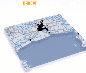 Places with similar names to Ban Don, Thailand ::
Disclaimer :: Information on this page comes without warranty of any kind |
||
|
Where is Ban Don? Elevation and coordinates ::
Latitude (lat): 13°9'0"N Longitude (lon): 100°1'0"E
Elevation (approx.): 4m (map arrows pan, magnifying glasses zoom) |
||
|
Visiting Ban Don? Hotel/Accommodation ::
Book a hotel in Ban Don Travel Guide ::
Buy a travel guide for Thailand rental cars ::
car rental offers GPS waypoint ::
download a GPX waypoint (PoI) of Ban Don for your GPS receiver
|
||