|
search place name
|
||
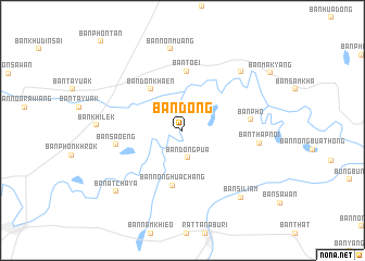
Ban Dong (Surin, Thailand)Ban Dong is a town in the Surin region of Thailand. An overview map of the region around Ban Dong is displayed below.
regional and 3d topo map of Ban Dong, Thailand ::
Ban Dong airports ::
The nearest airport is ZVK - Savannakhet, located 161.1 km north east of Ban Dong.
Other airports nearby include NAK - Nakhon Ratchasima Khorat (195.4 km west), SNO - Sakon Nakhon (199.7 km north), PKZ - Pakse (212.0 km east), UTH - Udon Thani (245.2 km north west), Nearby towns ::
Ban Dong Pua (2.9km south) //
Ban Don Khaen (5.3km north west) //
Ban Nong Hua Chang (5.8km south) //
Ban Toei (6.1km north) //
Ban Sa-oeng (6.7km west) //
Ban Pho (6.8km east) //
Ban Thap Noi (7.7km east) //
Ban Non Muang (8.4km north) //
Ban Don Mong (8.4km north east) //
Ban Khilek (8.5km west) //
Ban Si Liam (9.0km south east) //
Ban Atchaya (9.1km south west) //
[all distances 'as the bird flies' and approximate] 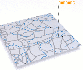 Places with similar names to Ban Dong, Thailand ::
Disclaimer :: Information on this page comes without warranty of any kind |
||
|
Where is Ban Dong? Elevation and coordinates ::
Latitude (lat): 15°24'43"N Longitude (lon): 103°49'45"E
Elevation (approx.): 127m (map arrows pan, magnifying glasses zoom) |
||
|
Visiting Ban Dong? Hotel/Accommodation ::
Book a hotel in Ban Dong Travel Guide ::
Buy a travel guide for Thailand rental cars ::
car rental offers GPS waypoint ::
download a GPX waypoint (PoI) of Ban Dong for your GPS receiver
|
||