|
search place name
|
||
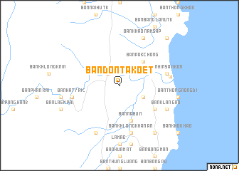
Ban Don Ta Koet (Chumphon, Thailand)Ban Don Ta Koet is a town in the Chumphon region of Thailand. An overview map of the region around Ban Don Ta Koet is displayed below.
regional and 3d topo map of Ban Don Ta Koet, Thailand ::
Ban Don Ta Koet airports ::
The nearest airport is NST - Nakhon Si Thammarat Cha Ian, located 188.0 km south east of Ban Don Ta Koet.
Other airports nearby include HKT - Phuket Intl (218.2 km south west), Nearby towns ::
Lang Suan (2.6km north west) //
Ban Khlong Rang (4.1km south east) //
Ban Pak Chong (5.2km north east) //
Ban Na Bun (5.9km south) //
Ban Huai Kruat (6.6km south east) //
Ban Hat Yai (2) (7.5km west) //
Ban Khlong Khanan (7.6km south) //
Ban Hin Sam Kon (7.5km east) //
Ban Pak Nam (8.0km east) //
Ban Khao Chok (8.3km south west) //
Ban Klang Ao (8.2km south east) //
Ban Chamuk Phrong (1) (8.2km south east) //
Ban Khao Nam Sap (8.3km north east) //
Ban Huai Chorakhe (9.2km south east) //
Ban Bang Yi (10.4km north east) //
[all distances 'as the bird flies' and approximate] 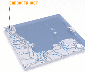 Places with similar names to Ban Don Ta Koet, Thailand ::
// Ban Don Takiat (TH)
Disclaimer :: Information on this page comes without warranty of any kind |
||
|
Where is Ban Don Ta Koet? Elevation and coordinates ::
Latitude (lat): 9°56'0"N Longitude (lon): 99°5'0"E
Elevation (approx.): 8m (map arrows pan, magnifying glasses zoom) |
||
|
Visiting Ban Don Ta Koet? Hotel/Accommodation ::
Book a hotel in Ban Don Ta Koet Travel Guide ::
Buy a travel guide for Thailand rental cars ::
car rental offers GPS waypoint ::
download a GPX waypoint (PoI) of Ban Don Ta Koet for your GPS receiver
|
||