|
search place name
|
||
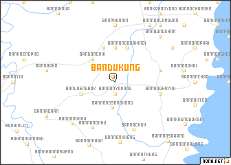
Ban Duk Ung (Ubon Ratchathani, Thailand)Ban Duk Ung is a town in the Ubon Ratchathani region of Thailand. An overview map of the region around Ban Duk Ung is displayed below.
regional and 3d topo map of Ban Duk Ung, Thailand ::
Ban Duk Ung airports ::
The nearest airport is PKZ - Pakse, located 61.1 km east of Ban Duk Ung.
Other airports nearby include ZVK - Savannakhet (172.0 km north), REP - Siem-reap Siem Reap (237.7 km south west), Nearby towns ::
Ban Non Yanang (1.9km south) //
Ban Nong Song Hong (4.2km south) //
Ban Don Chik (5.2km north west) //
Ban Muang Maet (5.6km north) //
Ban Nong Bua Hi Noi (5.8km north) //
Ban Na Ngam Chat Hi (5.8km north) //
Ban Loeng Bak (5.7km west) //
Ban Don Ko (7.4km east) //
Ban Ang Hin Yai (7.4km east) //
Ban Khaem Nua (8.2km south west) //
Ban Nong Khu (8.2km south west) //
Ban Na Chum (8.3km south) //
Ban Nong Khu (9.5km south west) //
Ban Bung Kham (10.3km north east) //
[all distances 'as the bird flies' and approximate]  Places with similar names to Ban Duk Ung, Thailand ::
// Ban Na Takang (TH)
// Ban Takang (TH)
// Ban Ta Koeng (TH)
// Ban Ta Kong (TH)
// Ban Ta Kong (TH)
// Ban Takong (TH)
// Ban Takong (TH)
// Bendoagung (ID)
// Ban Daknék (LA)
// Bintagoungou (ML)
Disclaimer :: Information on this page comes without warranty of any kind |
||
|
Where is Ban Duk Ung? Elevation and coordinates ::
Latitude (lat): 15°4'0"N Longitude (lon): 105°13'0"E
Elevation (approx.): 141m (map arrows pan, magnifying glasses zoom) |
||
|
Visiting Ban Duk Ung? Hotel/Accommodation ::
Book a hotel in Ban Duk Ung Travel Guide ::
Buy a travel guide for Thailand rental cars ::
car rental offers GPS waypoint ::
download a GPX waypoint (PoI) of Ban Duk Ung for your GPS receiver
|
||