|
search place name
|
||
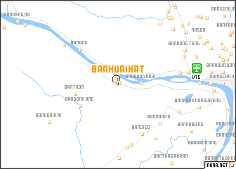
Ban Huai Hat (Nong Khai, Thailand)Ban Huai Hat is a town in the Nong Khai region of Thailand. An overview map of the region around Ban Huai Hat is displayed below.
regional and 3d topo map of Ban Huai Hat, Thailand ::
Ban Huai Hat airports ::
The nearest airport is VTE - Vientiane Wattay Intl, located 12.3 km east of Ban Huai Hat.
Other airports nearby include UTH - Udon Thani (73.4 km south east), LOE - Loei (96.7 km south west), SNO - Sakon Nakhon (196.6 km south east), LPQ - Luang Prabang Luang Phabang Intl (216.1 km north), Nearby towns ::
Ban Tha Kathin (0.5km north east) //
Ban Phra Bat (0.7km north west) //
Ban Huai Hom (1.7km north) //
Ban Nong Pawi (3.5km east) //
Ban Don Kang (6.6km south west) //
Ban Thon (6.6km west) //
Ban Ang (7.9km north west) //
Ban Sieo (8.7km south east) //
Ban Na Pho (8.9km south east) //
Ban Dong Bang (10.3km south east) //
Ban Pha Tang (10.3km north west) //
Ban Na Lièn (12.1km north east) //
[all distances 'as the bird flies' and approximate]  Places with similar names to Ban Huai Hat, Thailand ::
// Ban Hua Hat (TH)
// Ban Hua Hat (TH)
// Ban Hua Hat (TH)
// Ban Hua Hot (TH)
// Ban Huai Huat (TH)
// Ban Huai Hut (TH)
// Ban Houahat (LA)
// Ban Houahat (LA)
// Ban Houahat (LA)
// Ban Houahat (LA)
Disclaimer :: Information on this page comes without warranty of any kind |
||
|
Where is Ban Huai Hat? Elevation and coordinates ::
Latitude (lat): 17°57'55"N Longitude (lon): 102°27'0"E
Elevation (approx.): 198m (map arrows pan, magnifying glasses zoom) |
||
|
Visiting Ban Huai Hat? Hotel/Accommodation ::
Book a hotel in Ban Huai Hat Travel Guide ::
Buy a travel guide for Thailand rental cars ::
car rental offers GPS waypoint ::
download a GPX waypoint (PoI) of Ban Huai Hat for your GPS receiver
|
||