|
search place name
|
||
Ban Kaeng (Sara Buri, Thailand)Ban Kaeng is a town in the Sara Buri region of Thailand. An overview map of the region around Ban Kaeng is displayed below.
regional and 3d topo map of Ban Kaeng, Thailand ::

Ban Kaeng airports ::
The nearest airport is BKK - Bangkok Intl, located 81.3 km south west of Ban Kaeng.
Other airports nearby include NAK - Nakhon Ratchasima Khorat (128.2 km east), UTP - Rayong U Taphao Intl (208.8 km south), HHQ - Prachuap Khiri Khan Hua Hin (239.4 km south west), Nearby towns ::
Ban Sung Yang (1.9km south) //
Ban Takut (1.9km south) //
Ban Kut Ngong (1.8km east) //
Ban Kok (1) (1.8km west) //
Ban Lup Lao (1.8km east) //
Ban Tha Yiam (1.8km east) //
Ban Muang (3) (1.8km west) //
Ban Satu (1.8km west) //
Ban Tao Pun (2.6km north east) //
Ban Kluai (2.6km south west) //
Ban Nong Bua (2) (2.6km south east) //
Ban Dong Yang (4.0km north east) //
Ban Phia Khwa(1) (4.0km north west) //
Ban Si Tha (4.1km north east) //
Ban Huai Li (2) (4.1km south east) //
Ban Lat Khao Pun (5.2km north west) //
Sara Buri (5.2km south west) //
Ban Song Khon Tai (5.3km north east) //
Ban Huai Chorakhe (5.6km south) //
Ban Kut (5.7km west) //
Ban Dao Ruang (5.7km west) //
Ban Tanot (5.7km west) //
Ban Non Kho (5.8km south) //
Kaeng Khoi (6.2km north east) //
Ban Pa Phai (6.2km east) //
Ban Nong Sai (6.6km north east) //
Ban Huai Bong Nua (6.5km north west) //
Ban Huai Bong (1) (6.5km north west) //
Ban Nong Song Maeo (6.6km south east) //
[all distances 'as the bird flies' and approximate] 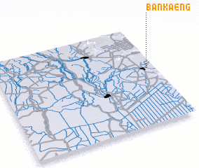 Places with similar names to Ban Kaeng, Thailand ::
// Ban Kang (LA)
// Banakang (PH)
// Bangong (PH)
// Binguang (PH)
// Bincong (PH)
// Benking (AT)
// Ban A Kiang (TH)
// Ban Ao Kung (TH)
// Ban Kaeng (TH)
// Ban Kaeng (TH)
Disclaimer :: Information on this page comes without warranty of any kind |
||
|
Where is Ban Kaeng? Elevation and coordinates ::
Latitude (lat): 14°34'0"N Longitude (lon): 100°57'0"E
Elevation (approx.): 19m (map arrows pan, magnifying glasses zoom) |
||
|
Visiting Ban Kaeng? Hotel/Accommodation ::
Book a hotel in Ban Kaeng Travel Guide ::
Buy a travel guide for Thailand rental cars ::
car rental offers GPS waypoint ::
download a GPX waypoint (PoI) of Ban Kaeng for your GPS receiver
|
||