|
search place name
|
||
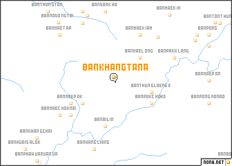
Ban Khang Ta Na (Phrae, Thailand)Ban Khang Ta Na is a town in the Phrae region of Thailand. An overview map of the region around Ban Khang Ta Na is displayed below.
regional and 3d topo map of Ban Khang Ta Na, Thailand ::
Ban Khang Ta Na airports ::
The nearest airport is LPT - Lampang, located 36.2 km north west of Ban Khang Ta Na.
Other airports nearby include PRH - Phrae (49.4 km east), PHS - Phitsanulok (148.7 km south east), Nearby towns ::
Ban Mae Long (5.5km north east) //
Ban Thung Laeng (1) (5.6km east) //
Ban Mae Bong (6.1km south west) //
Ban Pak Chok (1) (6.4km south east) //
Ban Ai Lim (7.2km south) //
Ban Mae Pak (7.7km south west) //
Ban Mae Kiam (8.6km north east) //
Ban Kem (8.6km north east) //
Ban Chae Fa (8.6km south west) //
Ban Mae Chok (9.8km north east) //
[all distances 'as the bird flies' and approximate]  Places with similar names to Ban Khang Ta Na, Thailand :: Disclaimer :: Information on this page comes without warranty of any kind |
||
|
Where is Ban Khang Ta Na? Elevation and coordinates ::
Latitude (lat): 18°0'47"N Longitude (lon): 99°42'55"E
Elevation (approx.): 164m (map arrows pan, magnifying glasses zoom) |
||
|
Visiting Ban Khang Ta Na? Hotel/Accommodation ::
Book a hotel in Ban Khang Ta Na Travel Guide ::
Buy a travel guide for Thailand rental cars ::
car rental offers GPS waypoint ::
download a GPX waypoint (PoI) of Ban Khang Ta Na for your GPS receiver
|
||