|
search place name
|
||
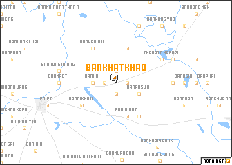
Ban Khatkhao (Roi Et, Thailand)Ban Khatkhao is a town in the Roi Et region of Thailand. An overview map of the region around Ban Khatkhao is displayed below.
regional and 3d topo map of Ban Khatkhao, Thailand ::
Ban Khatkhao airports ::
The nearest airport is ZVK - Savannakhet, located 118.3 km north east of Ban Khatkhao.
Other airports nearby include SNO - Sakon Nakhon (128.6 km north), UTH - Udon Thani (178.0 km north west), NAK - Nakhon Ratchasima Khorat (221.3 km south west), VTE - Vientiane Wattay Intl (246.7 km north west), Nearby towns ::
Ban Don Kok (1.8km east) //
Ban Kai Pla (1.9km south) //
Ban Don Chai (1.9km north) //
Ban Ma-u (1.8km west) //
Ban Ku (3.6km west) //
Ban Pa Sum (4.0km south east) //
Ban Don Samran Tai (5.8km north) //
Ban Um Mao (5.8km south) //
Ban Nikhom (6.5km south west) //
Ban Tha Bo (6.6km south east) //
Ban Wai Lum (6.6km north west) //
Thawatchaburi (8.0km north east) //
[all distances 'as the bird flies' and approximate] 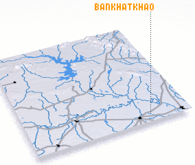 Places with similar names to Ban Khatkhao, Thailand :: Disclaimer :: Information on this page comes without warranty of any kind |
||
|
Where is Ban Khatkhao? Elevation and coordinates ::
Latitude (lat): 16°5'0"N Longitude (lon): 103°46'0"E
Elevation (approx.): 139m (map arrows pan, magnifying glasses zoom) |
||
|
Visiting Ban Khatkhao? Hotel/Accommodation ::
Book a hotel in Ban Khatkhao Travel Guide ::
Buy a travel guide for Thailand rental cars ::
car rental offers GPS waypoint ::
download a GPX waypoint (PoI) of Ban Khatkhao for your GPS receiver
|
||